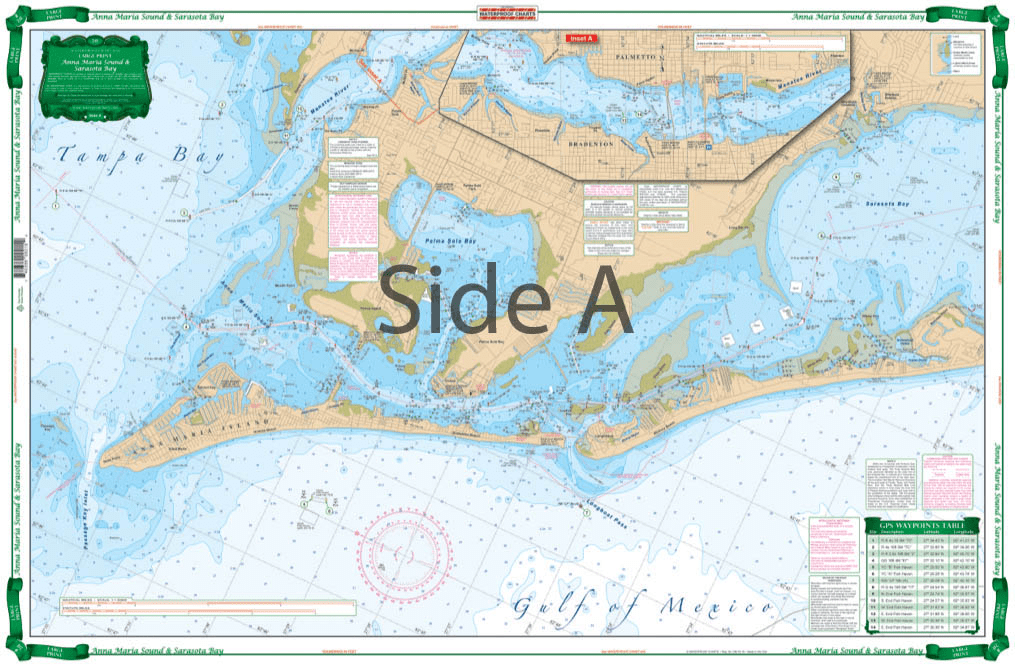
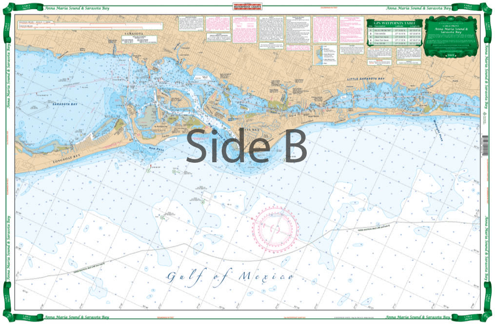

Very large blown up coverage from Anna Maria Island south to Little Sarasota Bays and up the Manatee River to Bradenton and Palmetto. Detail for Sarasota. Large Place names make areas easy to find. A total of 19 plotted and indexed GPS Waypoints make it easy to set up your electronics. Don’t go anywhere without this Anna Maria Sound and Sarasota Bays navigation chart! We use data compiled from 2 NOAA charts to give you a more comprehensive overview of this boating area. This nautical map has a very large blown up coverage from Anna Maria Island south to Little Sarasota Bays and up the Manatee River to Bradenton and Palmetto. Detail are also included for Sarasota. Large place names make areas easy to find, even when boating at high speeds! (Though we don’t recommend you read and drive). A total of 19 plotted and indexed GPS Waypoints make it easy to set up your electronics. Get a second copy of this navigation map. Why? Because you’ll love the vibrant colors so much you’ll get it framed and hung on your wall. Information from 2 NOAA Charts: #11425 and #11411. Nautical chart is 25″ X 38″. WGS84 – World Mercator Datum.


(Model Course 3.11) Safety Investigation into Marine Casualties and Incidents, 2014 Edition
Product arrived promptly and was current and in good condition… But the cost to ship seems excessive and more than the real cost to ship adding profit to the sale no doubt. If as they say this is a small business shipping labor is a part of the business and anything other than the cost of the actual UPS or USPS cost is an additional charge. They do have a lot of products and they do act promptly with as promised service and delivery.
It took four days for the package to get to my address in Brazil. That’s amazing!
NGA Chart 24: Great Circle Sailing Chart of the South Atlantic Ocean