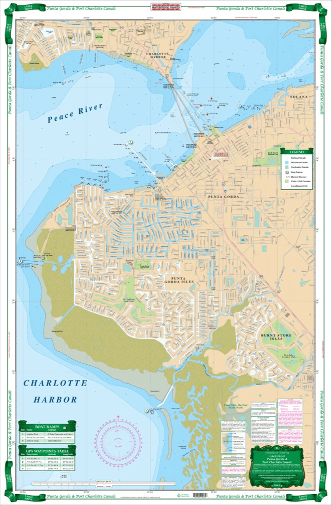
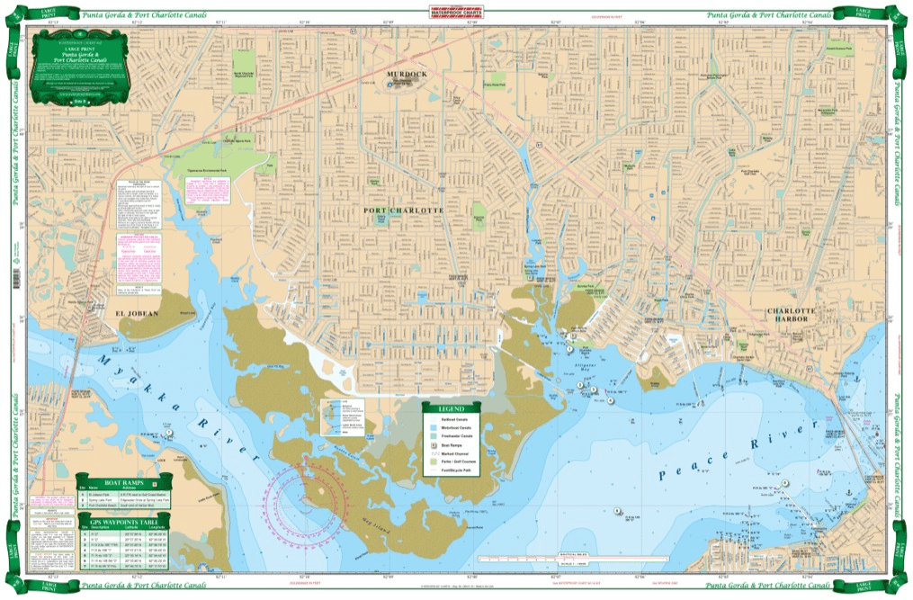
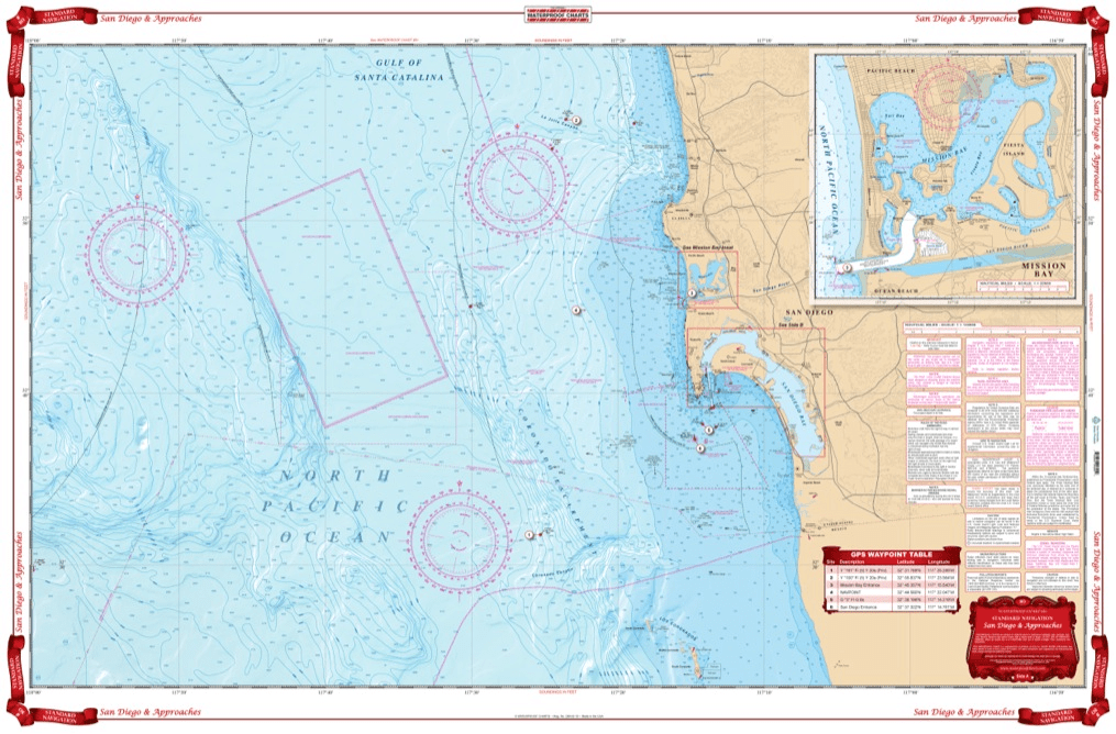
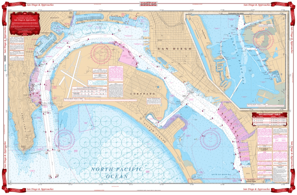
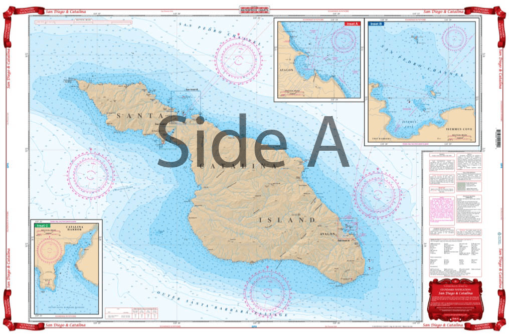
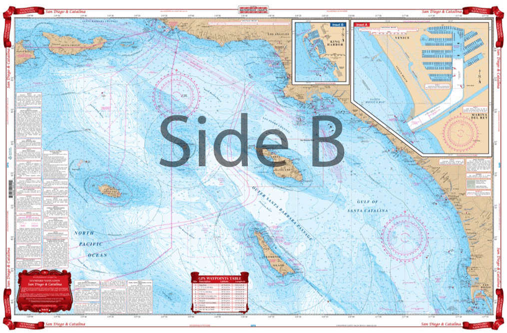
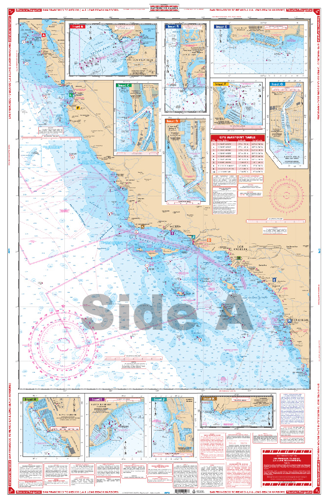
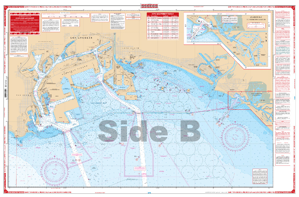
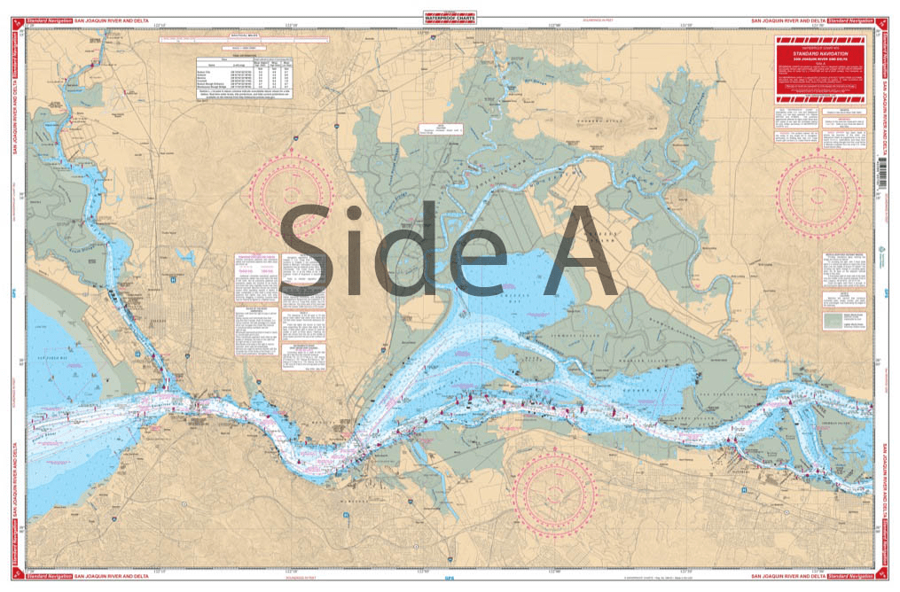
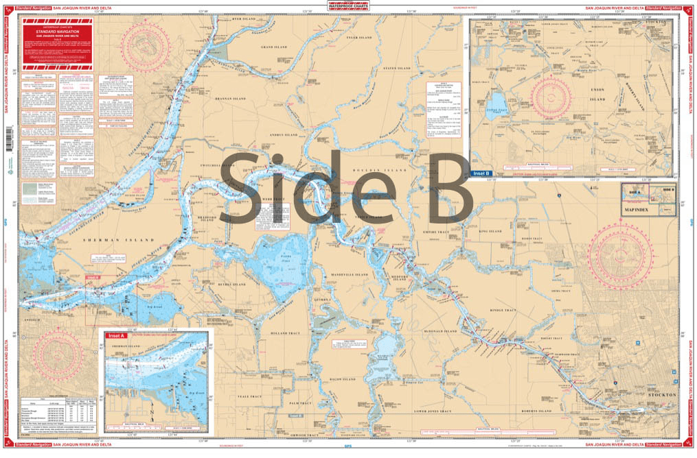
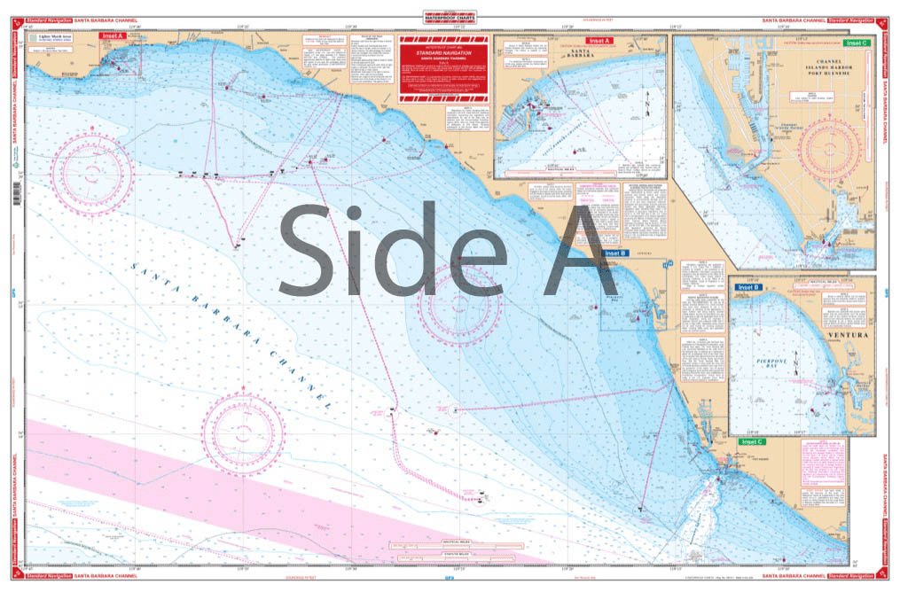
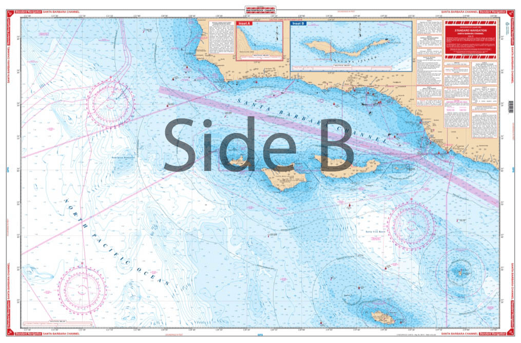
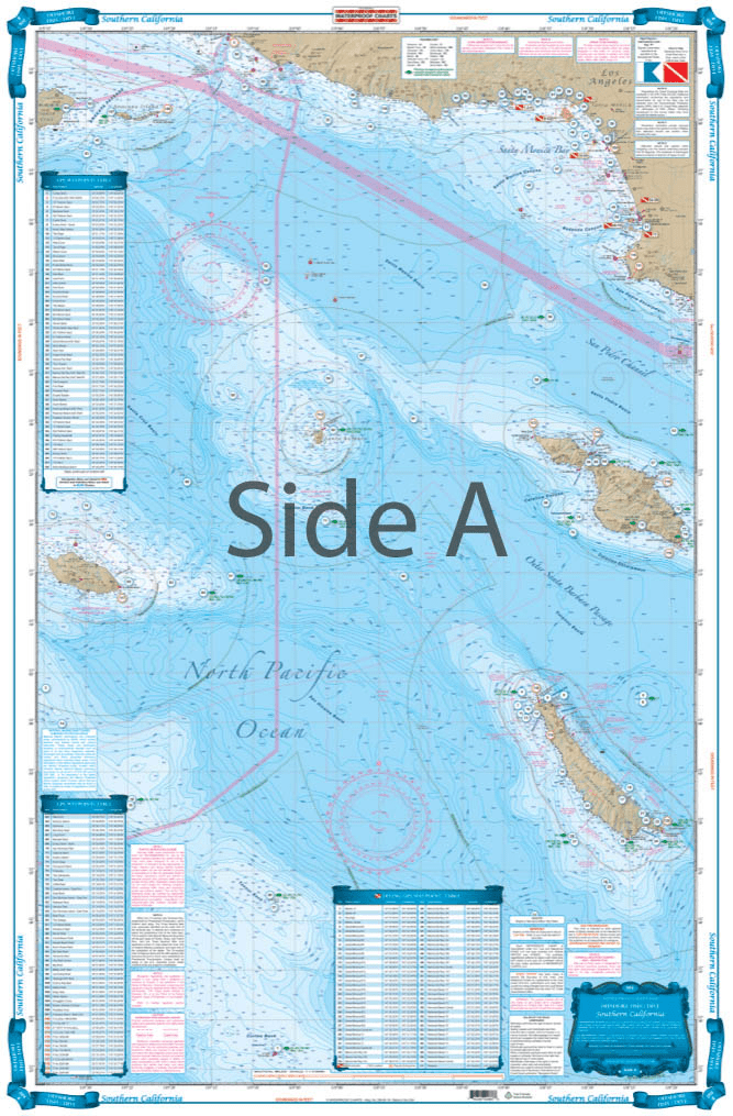
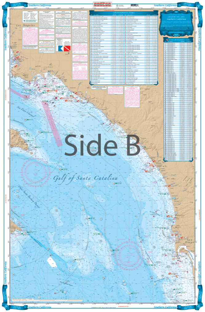
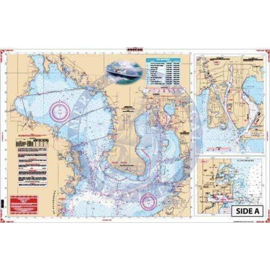
Collection: Waterproof Charts

Our waterproof charts are an excellent tool for recreational sailors to navigate with. Using nautical data from the National Oceanic and Atmospheric Administration (NOAA) and National Geospatial-Intelligence Agency (NGA) these charts cover some of the most popular inlets, waterways, and commonly sailed routes in U.S. waters and in the Caribbean. They can be used a substitute to standard nautical charts for small recreation boats only. These charts are laminated and will be protected from any exposure to water.
Categories
62 of 76 products
Sale
Florida Bay Large Print Navigation Chart 33E
Sale price
$27.95
List price
$39.95
Sale
Florida Middle Keys Inshore Fishing Chart 34F
Sale price
$27.95
List price
$39.95
Sale
Florida to Puerto Rico and Mona Passage Navigation Chart 16
Sale price
$27.95
List price
$39.95
Sale
Fort Myers to Tampa Bay Navigation Chart 21
Sale price
$27.95
List price
$39.95
Sale
Grand Bahama and The Abacos Navigation Chart 38A
Sale price
$27.95
List price
$39.95
Sale
Jacksonville and St. Johns River Navigation Chart 37
Sale price
$27.95
List price
$39.95
Sale
Jacksonville to Daytona Offshore Fish and Dive Chart 125F
Sale price
$27.95
List price
$39.95
Sale
Jacksonville to St. Augustine Inshore Fishing Chart 44F
Sale price
$27.95
List price
$39.95
Sale
Key West and Lower Keys Lobster Inshore Fish and Dive Chart 110F
Sale price
$27.95
List price
$39.95
Sale
Lake Okeechobee Stuart to Fort Myers Beach Crossing Navigation Chart 20
Sale price
$27.95
List price
$39.95
Sale
Lostmans River to Whitewater Bay Navigation Chart 39
Sale price
$27.95
List price
$39.95
Sale
Lower Florida Keys Navigation Chart 34
Sale price
$27.95
List price
$39.95