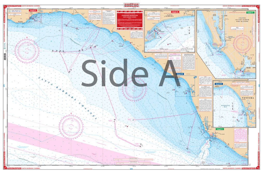
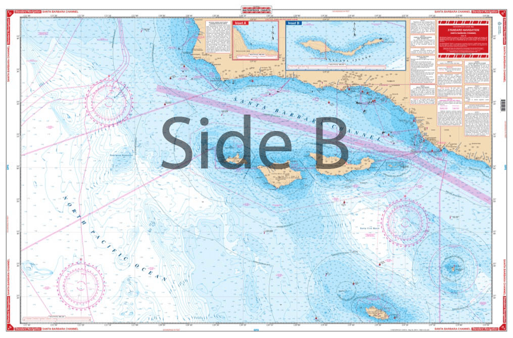


Covers the offshore area from Purisima Point southeast along the coast to Pt. Dume, south offshore to San Nicolas Island, and west to 121 degrees, 40 minutes west longitude. The reverse side details the coastal area from Santa Barbara Point to Port Hueneme. Detailed harbor blow-ups are included for Channel Islands Harbor, Ventura, Santa Barbara, Anacapa Island and Prisoners Harbor. Fueling facilities indicated. Navigate your vessel through the Santa Barbara Channel with ease using this navigation map. It covers the offshore area from Purisima Point southeast along the coast to Pt Dume, south offshore to San Nicolas Island, and west to 121 degrees, 40 minutes west longitude. The reverse side details the coastal area from Santa Barbara Point to Port Hueneme. Detailed harbor blow-ups are included for Channel Islands Harbor, Ventura, Santa Barbara, Anacapa Island and Prisoners Harbor. Fueling facilities are conveniently indicated to ensure you always have a full tank. The vibrant colors of this marine map make it excellent for framing for your home or giving as a gift. Information from 3 NOAA charts: #18720, #18729, and #18725. Nautical Chart is 25″ X 38″. WGS84 – World Mercator Datum.


I wanted a quality chart delivered promptly at an acceptable price.
Mission accomplished...
Order placement and pickup was efficient and easy! I made an order mistake and they fixed it quickly for me. Hal was such a pleasure to talk to as well. Product is as described. Thanks!
My wife and I are still a few years away from casting off the dock lines on this journey, but Skipper Bob's insights have really framed my thinking about the Big Picture. I burned through the book in just a few days and have already changed some of our early planning based on the information I gleaned.
Thanks to all of you for keeping this valuable resource readily available!