


Electronic GPS navigation is great, but I always sail unfamiliar waters with paper charts as back up. These are high quality maps that were delivered in under a week rolled in a tube. Lots of easily readable detail. I also find that it is easier to gain the "big picture' of the waters with a large paper chart, versus endlessly scrolling on a digital screen.
Ports and Passes: The Pacific Northwest Tide and Current Guide, 2025 Edition (Spiral Bound)
excellence service and timing
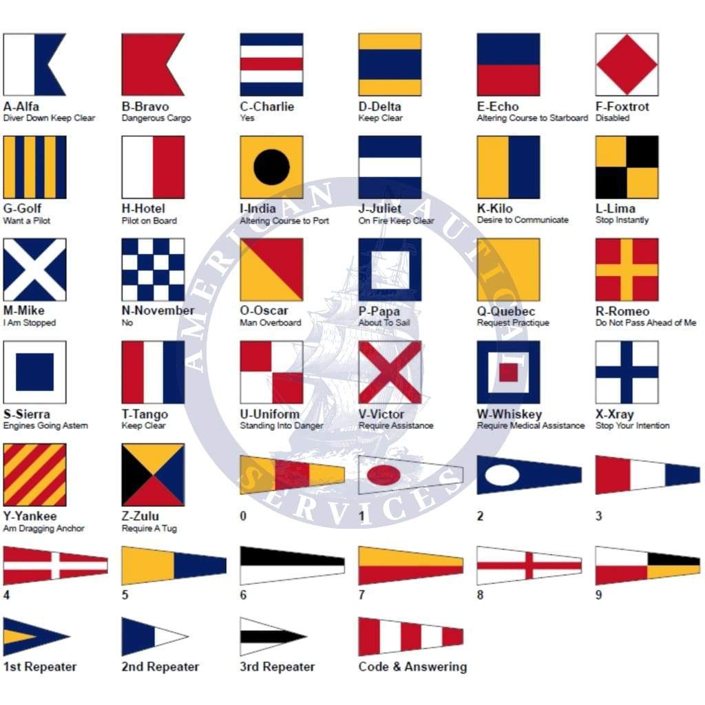
Exactly what I needed for practice before my next upgrade, and delivered quickly. Already recommended to a few fellow mariners
I bought e copy but no access to download it. This restriction not visible or provided before purchase