


I bought this book as a gift for someone who for years had had his own sailboat. He wrote to thank me for it, saying that the photos were fantastic and that he loved the book. The Black and White photography makes the photos stand out and the photos are understated and unique. Truly a wonderful book.
American National Services offered the best price on Murphy’s study guide books. They arrived quickly and in perfect condition. Can definitely recommend going through ANS. It’s worth it for your maritime career!
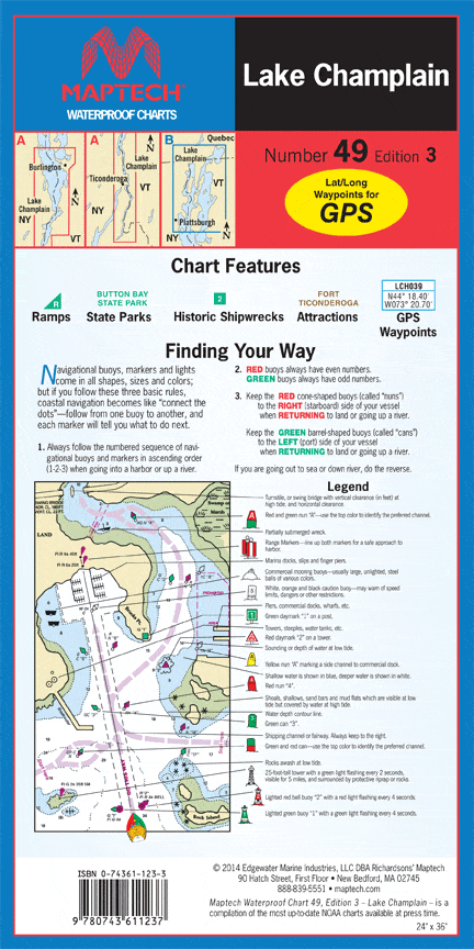
The chart was unusable due to too much data being printed which cluttered up the view and obscured contours. Also, no compass rose was included.
(Model Course 3.11) Safety Investigation into Marine Casualties and Incidents, 2014 Edition