
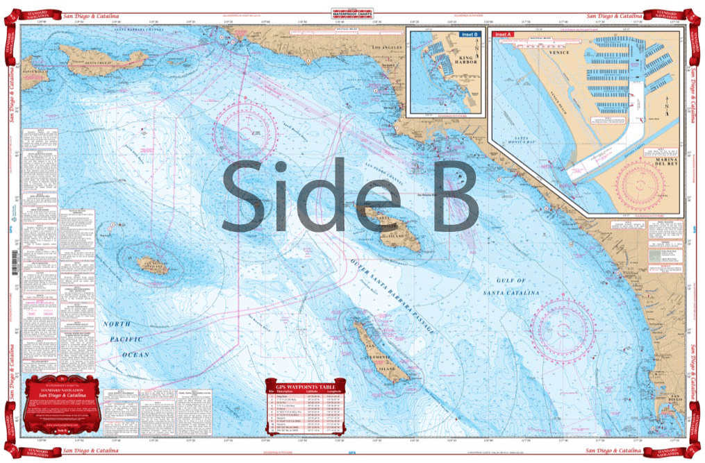
From Santa Barbara south to San Diego, this chart covers the waters offshore to San Nicholas Island with details for Santa Monica Bay and Marina Del Rey and King Harbor on one side. The reverse side details Santa Catalina Island with detailed blow ups for Isthmus Cove and Two Harbors, Avalon Bay, and Catalina Harbor. GPS Waypoints are printed directly on the chart. For journeys between San Diego and Catalina Island, this nautical map has all the detail you need. From Santa Barbara south to San Diego, this navigation chart covers the waters offshore to San Nicholas Island with details for Santa Monica Bay and Marina Del Rey and King Harbor on one side. The reverse side details Santa Catalina Island with detailed blow ups for Isthmus Cove and Two Harbors, Avalon Bay, and Catalina Harbor. GPS waypoints are printed directly on the navigation map. If you are a regular in the area, or want to remember your trip, have this navigation chart framed and display it in your home or office. Information from 3 NOAA Charts: #18740, #18744 and #18757. Nautical Chart is 25″ X 38″. WGS84 – World Mercator Datum.


I had a question about delivery, it was answered promptly. The order was processed the same day as ordered and shipping was as expected.
They were prompt, they had excellent packaging that protected the book and good communication about the order. Will definitely use them again!
As an American, American Nautical Services is my go-to for purchasing European sailing charts and pilot books at a reasonable price.
Very satisfied with ANS Team, order processed very easy, with in a couple of hours I got tracking details and our order was dispatched. This guys are simply what expedite service means. Thank you!
Ordered a chat book. It arrived promply and well packed. New and in pristine condition.