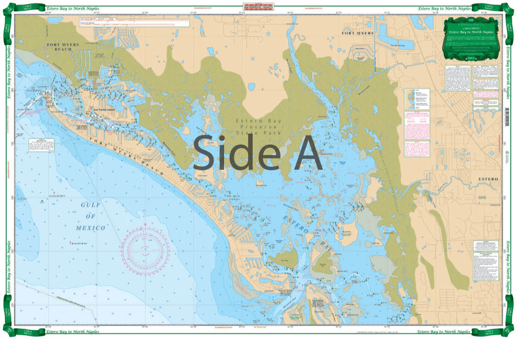
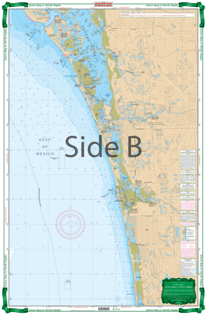
The Estero Bay to North Naples Nautical Chart has detailed coverage of this shallow area with local names and channels. The north side covers Fort Myers Beach, Matanzas Pass, Hurricane Bay, Estero Island and north Estero Bay to Mound Key, including the Hendry Creek, Mullock Creek, the Estero River, Big Carlos Pass, and the Lovers Key State Park area. The south side covers southern Estero Bay, Spring Creek, Fish Trap Bay, New Pass south thru Bonita Beach and the Vanderbilt Channel and Outer Clam Bay. Continues south thru inside route behind Wiggins Pass with complete marker detail and south to the Vanderbilt Beach waterways and canals. Extensive field work details channels and markers available from no other source. Information from county sources, NOAA charts, USGS topographical maps and local experts. Beautiful colors make it suitable for framing. WGS84-World Mercator Datum.


Excellent Services
I wanted a quality chart delivered promptly at an acceptable price.
Mission accomplished...
Order placement and pickup was efficient and easy! I made an order mistake and they fixed it quickly for me. Hal was such a pleasure to talk to as well. Product is as described. Thanks!
My wife and I are still a few years away from casting off the dock lines on this journey, but Skipper Bob's insights have really framed my thinking about the Big Picture. I burned through the book in just a few days and have already changed some of our early planning based on the information I gleaned.
Thanks to all of you for keeping this valuable resource readily available!