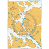
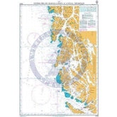
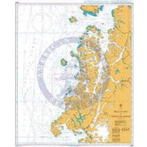
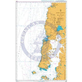
Collection: Nautical Charts

Nautical Charts

Nautical charts are available in two general formats: physical charts, which are printed on paper and electronic charts, which are displayed on an electronic chart display and information system (ECDIS). Each type of nautical chart may be purchased online or ordered over the telephone.

British Admiralty nautical charts are produced by the United Kingdom Hydrographic Office (UKHO) and have been updated to conform to the most recent notices to mariners. They conform to nautical chart carriage requirements detailed in in Safety of Life at Sea (SOLAS) Chapter V Regulation 2.2 and also meet the carriage requirements in SOLAS Chapter V Regulation 19.2.1.4.

Nautical charts and other information services provided by the UKHO are widely-regarded as standard-setting in the industry. British Admiralty nautical charts are designed to provide mariners with the most up-to-date nautical information and keep fleets in compliance with prevailing legislation; legislation that is intended to keep crews safe.

The U.S. National Oceanic and Atmospheric Administration (NOAA) also produces high-quality nautical charts that comply with SOLAS Chapter V Regulation 2.2 carriage requirements and also meet the carriage requirements in SOLAS Chapter V Regulation 19.2.1.4. NOAA nautical charts are printed "on-demand" so that they are updated to include the most recent information available.

NOAA nautical charts have an equally impressive provenance and are highly regarded for their accuracy, ease-of-use and durability. NOAA charts are printed on water resistant paper, which is specifically designed to stand up to wet and damp maritime environments.

All nautical charts available are updated to include information provided by NOAA and UKHO as reported in notices to mariners. It is important that mariners with carriage compliance requirements stay aware of subsequent notices to mariners and update their chart libraries accordingly.

British Admiralty charts produced by the UKHO and NOAA nautical charts are available for a range of locales. Browse the entire selection of British Admiralty and NOAA nautical charts that are available. Mariners are bound to find the nautical chart they need to stay safe and compliant in the list of titles available online from British Admiralty and NOAA nautical charts. No matter where your voyage will take you, British Admiralty and NOAA have the charts you need to plan a successful passage and remain compliant with your flag state's nautical chart carriage requirements.

Filter By
7842 products
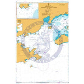
British Admiralty Nautical Chart 4479: The passages between Panay, Negros and Cebu
Price
$55.95
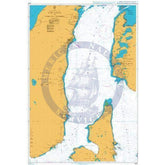
British Admiralty Nautical Chart 4478: Samar Sea and Eastern part of Visayan Sea
Price
$55.95
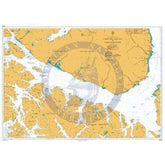
British Admiralty Nautical Chart 4472: Initao Point to Butuan Bay
Price
$55.95
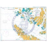
British Admiralty Nautical Chart 4471: Mindanao North West Coast. Lanboyan Point to Initao Point
Price
$55.95
British Admiralty Nautical Chart 4470: Basilan Strait including Basilan Island and the Pilas Group
Price
$55.95
British Admiralty Nautical Chart 446: Anvers Island to Renaud Island
Price
$55.95
British Admiralty Nautical Chart 4413: Philippine Islands, Subic Bay to Jintotolo Island
Price
$55.95
British Admiralty Nautical Chart 4412: Cape Engano to Yog Point
Price
$55.95
British Admiralty Nautical Chart 4411: Philippine Islands, Luzon – West Coast, Cabra Island to Cape Bojeador
Price
$55.95
British Admiralty Nautical Chart 4410: Philippine Islands and Taiwan, Luzon Strait
Price
$55.95
British Admiralty Nautical Chart 4406: Canada, Hudson Strait and Bay
Price
$55.95
British Admiralty Nautical Chart 436: Canal de Sao Sebastiao
Price
$55.95
British Admiralty Nautical Chart 433: Angra dos Reis and TEBIG Oil Terminal and Approaches
Price
$55.95
British Admiralty Nautical Chart 432: Approaches to Terminal da Ilha Guaiba
Price
$55.95
British Admiralty Nautical Chart 430: Aalborg
Price
$55.95
British Admiralty Nautical Chart 429: Denmark, Limfjorden, Hals to Aalborg. Approaches to Hals
Price
$55.95
British Admiralty Nautical Chart 428: Denmark – Limfjorden, Løgstør to Aalborg
Price
$55.95
British Admiralty Nautical Chart 427: Denmark – Limfjorden, Mors to Løgstør
Price
$55.95
British Admiralty Nautical Chart 426: Denmark, Limfjorden, Thyborøn to Mors
Price
$55.95
British Admiralty Nautical Chart 4267: Paso Nuevo to Paso Del Hambre
Price
$55.95
British Admiralty Nautical Chart 4266: Paso del Hambre to Paso Tortuoso
Price
$55.95
British Admiralty Nautical Chart 4265: Paso Tortuoso to Paso Del Mar
Price
$55.95
British Admiralty Nautical Chart 4264: Paso Del Mar to Islotes Evangelistas
Price
$55.95
British Admiralty Nautical Chart 4262: Paso Tortuoso and Canal Jeronimo
Price
$55.95
British Admiralty Nautical Chart 4259: Estrecho de Magallanes to Canal Trinidad
Price
$55.95
British Admiralty Nautical Chart 4255: Isla Guafo to Golfo de Penas
Price
$55.95
British Admiralty Nautical Chart 4250: Bahia Corral to Isla Guafo
Price
$55.95
British Admiralty Nautical Chart 4249: Chile, Bahía San Vicente
Price
$55.95
British Admiralty Nautical Chart 4248: Chile, Ports in Bahía Concepción
Price
$55.95
British Admiralty Nautical Chart 4247: Approaches to Bahia Concepcion and Bahia San Vicente
Price
$55.95
British Admiralty Nautical Chart 4246: Golfo de Arauco to Cabo Carranza
Price
$55.95
British Admiralty Nautical Chart 4245: Golfo de Arauco to Bahia Corral
Price
$55.95
British Admiralty Nautical Chart 4243: San Antonio
Price
$55.95
British Admiralty Nautical Chart 4242: Chile, Valparaiso
Price
$55.95
British Admiralty Nautical Chart 4239: BAHIA QUINTERO
Price
$55.95
British Admiralty Nautical Chart 4238: BAHIA VALPARAISO TO BAHIA QUINTERO
Price
$55.95
British Admiralty Nautical Chart 4237: Chile, Bahía Coquimbo and Bahía Herradura Guayacán
Price
$55.95
British Admiralty Nautical Chart 4235: Bahia Valparaiso to Bahia Coquimbo
Price
$55.95
British Admiralty Nautical Chart 4232: Puerto Huasco
Price
$55.95
British Admiralty Nautical Chart 4231: Approaches to Puertos Caldera and Calderilla
Price
$55.95