Collection: Nautical Charts

Nautical Charts

Nautical charts are available in two general formats: physical charts, which are printed on paper and electronic charts, which are displayed on an electronic chart display and information system (ECDIS). Each type of nautical chart may be purchased online or ordered over the telephone.

British Admiralty nautical charts are produced by the United Kingdom Hydrographic Office (UKHO) and have been updated to conform to the most recent notices to mariners. They conform to nautical chart carriage requirements detailed in in Safety of Life at Sea (SOLAS) Chapter V Regulation 2.2 and also meet the carriage requirements in SOLAS Chapter V Regulation 19.2.1.4.

Nautical charts and other information services provided by the UKHO are widely-regarded as standard-setting in the industry. British Admiralty nautical charts are designed to provide mariners with the most up-to-date nautical information and keep fleets in compliance with prevailing legislation; legislation that is intended to keep crews safe.

The U.S. National Oceanic and Atmospheric Administration (NOAA) also produces high-quality nautical charts that comply with SOLAS Chapter V Regulation 2.2 carriage requirements and also meet the carriage requirements in SOLAS Chapter V Regulation 19.2.1.4. NOAA nautical charts are printed "on-demand" so that they are updated to include the most recent information available.

NOAA nautical charts have an equally impressive provenance and are highly regarded for their accuracy, ease-of-use and durability. NOAA charts are printed on water resistant paper, which is specifically designed to stand up to wet and damp maritime environments.

All nautical charts available are updated to include information provided by NOAA and UKHO as reported in notices to mariners. It is important that mariners with carriage compliance requirements stay aware of subsequent notices to mariners and update their chart libraries accordingly.

British Admiralty charts produced by the UKHO and NOAA nautical charts are available for a range of locales. Browse the entire selection of British Admiralty and NOAA nautical charts that are available. Mariners are bound to find the nautical chart they need to stay safe and compliant in the list of titles available online from British Admiralty and NOAA nautical charts. No matter where your voyage will take you, British Admiralty and NOAA have the charts you need to plan a successful passage and remain compliant with your flag state's nautical chart carriage requirements.

Filter by
103 of 7408 products
Overview Overview Clear all
British Admiralty Nautical Chart 529: Brazil - Southern Coast, Recife to Cabo de São Tomé
Price
$55.95
British Admiralty Nautical Chart 4813: North Pacific Ocean, Bering Sea, Southern Part
Price
$55.95
British Admiralty Nautical Chart 4810: North Pacific Ocean, West Coast of North America, Dixon Entrance to Unimak Pass
Price
$55.95
British Admiralty Nautical Chart 4806: North Pacific Ocean, San Francisco and Vancouver Island to Mendocino Fracture Zone
Price
$55.95
British Admiralty Nautical Chart 4805: Hawaiian Islands to the Aleutian Trench
Price
$55.95
British Admiralty Nautical Chart 4801: North Pacific Ocean, West Coast of United States and Canada, Mexican Border to Dixon Entrance
Price
$55.95
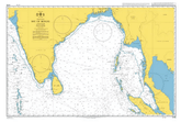
British Admiralty Nautical Chart 4706: Bay of Bengal
Price
$55.95
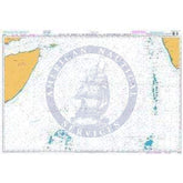
British Admiralty Nautical Chart 4703: Gulf of Aden to the Maldives and Seychelles Group
Price
$55.95
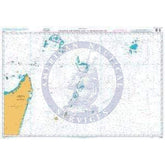
British Admiralty Nautical Chart 4702: Chagos Archipelago to Madagascar
Price
$55.95
British Admiralty Nautical Chart 4618: Pacific Ocean, Île Clipperton to Archipiélago de Colón
Price
$55.95
British Admiralty Nautical Chart 4608: Guayaquil to Valparaiso
Price
$55.95
British Admiralty Nautical Chart 4605: New Zealand to Fiji and Samoa Islands
Price
$55.95
British Admiralty Nautical Chart 4509: Western Portion of Japan
Price
$55.95
British Admiralty Nautical Chart 4506: Mariana Islands to the Gilbert Group (Kiribati)
Price
$55.95
British Admiralty Nautical Chart 4405: North Atlantic Ocean, Labrador Sea, Strait of Belle Isle to Davis Strait
Price
$55.95
British Admiralty Nautical Chart 4212: Drake Passage
Price
$55.95
British Admiralty Nautical Chart 4208: Ilha da Trindade to Tristan da Cunha Group
Price
$55.95
British Admiralty Nautical Chart 4207: Falkland Islands to Cabo Corrientes and Northeast Georgia Rise
Price
$55.95
British Admiralty Nautical Chart 4206: Tristan da Cunha Group to Discovery Seamounts and Islas Orcadas Rise
Price
$55.95
British Admiralty Nautical Chart 4204: South Atlantic and Indian Oceans, Walvis Bay to Maputo
Price
$55.95
British Admiralty Nautical Chart 4200: Rio de la Plata to Cabo de Hornos
Price
$55.95
British Admiralty Nautical Chart 4112: North Atlantic Ocean, Iceland to Greenland
Price
$55.95
British Admiralty Nautical Chart 4102: North Atlantic Ocean, Western Approaches to the British Isles
Price
$55.95
British Admiralty Nautical Chart 235: Davis Strait and South East Part of Baffin Bay
Price
$55.95
British Admiralty Nautical Chart 943: Molucca Sea to Manila Bay
Price
$41.75
British Admiralty Nautical Chart 558: South America - East Coast, Isla Leones to Estrecho de Magallanes Including the Falkland Islands
Price
$55.95
British Admiralty Nautical Chart 557: South America - East Coast, Argentina, Mar del Plata to Comodoro Rivadavia
Price
$55.95
British Admiralty Nautical Chart 539: Puerto Santa Cruz to Cabo Pilar including the Falkland Islands
Price
$55.95
British Admiralty Nautical Chart 4906: Antarctica, Weddell Sea
Price
$55.95
British Admiralty Nautical Chart 4904: Southern Ocean, Dronning Maud Land
Price
$55.95
British Admiralty Nautical Chart 4900: Ross Sea
Price
$55.95
British Admiralty Nautical Chart 4814: North Pacific Ocean, Bering Sea, Northern Part
Price
$55.95
British Admiralty Nautical Chart 4809: Hawaiian Islands
Price
$55.95
British Admiralty Nautical Chart 4794: Canada, Great Lakes / Grands Lacs, Continuation
Price
$55.95
British Admiralty Nautical Chart 4714: Indian Ocean, Cocos (Keeling) Islands to Île Saint-Paul
Price
$55.95
British Admiralty Nautical Chart 4713: Ile de la Reunion to Ile Saint-Paul
Price
$55.95
British Admiralty Nautical Chart 4712: Indian Ocean, Îles Crozet to Prince Edward Islands
Price
$55.95
British Admiralty Nautical Chart 4711: Ile Amsterdam to Iles Kerguelen
Price
$55.95
British Admiralty Nautical Chart 4710: Indian Ocean, Cape Leeuwin to Southeast Indian Ridge
Price
$55.95
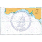
British Admiralty Nautical Chart 4709: Australia, South Coast
Price
$55.95