Collection: Nautical Charts

Nautical Charts

Nautical charts are available in two general formats: physical charts, which are printed on paper and electronic charts, which are displayed on an electronic chart display and information system (ECDIS). Each type of nautical chart may be purchased online or ordered over the telephone.

British Admiralty nautical charts are produced by the United Kingdom Hydrographic Office (UKHO) and have been updated to conform to the most recent notices to mariners. They conform to nautical chart carriage requirements detailed in in Safety of Life at Sea (SOLAS) Chapter V Regulation 2.2 and also meet the carriage requirements in SOLAS Chapter V Regulation 19.2.1.4.

Nautical charts and other information services provided by the UKHO are widely-regarded as standard-setting in the industry. British Admiralty nautical charts are designed to provide mariners with the most up-to-date nautical information and keep fleets in compliance with prevailing legislation; legislation that is intended to keep crews safe.

The U.S. National Oceanic and Atmospheric Administration (NOAA) also produces high-quality nautical charts that comply with SOLAS Chapter V Regulation 2.2 carriage requirements and also meet the carriage requirements in SOLAS Chapter V Regulation 19.2.1.4. NOAA nautical charts are printed "on-demand" so that they are updated to include the most recent information available.

NOAA nautical charts have an equally impressive provenance and are highly regarded for their accuracy, ease-of-use and durability. NOAA charts are printed on water resistant paper, which is specifically designed to stand up to wet and damp maritime environments.

All nautical charts available are updated to include information provided by NOAA and UKHO as reported in notices to mariners. It is important that mariners with carriage compliance requirements stay aware of subsequent notices to mariners and update their chart libraries accordingly.

British Admiralty charts produced by the UKHO and NOAA nautical charts are available for a range of locales. Browse the entire selection of British Admiralty and NOAA nautical charts that are available. Mariners are bound to find the nautical chart they need to stay safe and compliant in the list of titles available online from British Admiralty and NOAA nautical charts. No matter where your voyage will take you, British Admiralty and NOAA have the charts you need to plan a successful passage and remain compliant with your flag state's nautical chart carriage requirements.

Filter By
765 of 7876 products
North Atlantic Ocean North Atlantic Ocean Clear all
British Admiralty Nautical Chart 2603: United States – East Coast, Delaware River, Delaware Point to Little Tinicum Island
Price
$55.95
British Admiralty Nautical Chart 2488: Portland Harbor
Price
$55.95
British Admiralty Nautical Chart 2485: Approaches to Barbados
Price
$55.95
British Admiralty Nautical Chart 245: North Atlantic Ocean, Scotland to Iceland
Price
$55.95
British Admiralty Nautical Chart 235: Davis Strait and South East Part of Baffin Bay
Price
$55.95
British Admiralty Nautical Chart 2254: Valentia Island to River Shannon
Price
$55.95
British Admiralty Nautical Chart 2173: Loop Head to Slyne Head
Price
$55.95
British Admiralty Nautical Chart 2125: Valentia Island
Price
$55.95
British Admiralty Nautical Chart 20: France – West Coast, Île d'Ouessant to Pointe de la Coubre
Price
$55.95
British Admiralty Nautical Chart 1984: Galway Bay
Price
$55.95
British Admiralty Nautical Chart 1838: Bantry Bay Shot Head to Bantry
Price
$55.95
British Admiralty Nautical Chart 1791: Caledonian Canal
Price
$55.95
British Admiralty Nautical Chart 1764: Ria de Arousa
Price
$55.95
British Admiralty Nautical Chart 1727: Bolama and Approaches
Price
$55.95
British Admiralty Nautical Chart 1663: Saint - Louis to Riviere Saloum
Price
$55.95
British Admiralty Nautical Chart 1528: Boston Inner Harbor
Price
$55.95
British Admiralty Nautical Chart 1516: Boston Harbor
Price
$55.95
British Admiralty Nautical Chart 1365: Greenville to Harper
Price
$55.95
British Admiralty Nautical Chart 1364: Monrovia to Greenville
Price
$55.95
British Admiralty Nautical Chart 1128: North Atlantic Ocean, Banks West of the Hebrides
Price
$55.95
British Admiralty Nautical Chart 1125: Western Approaches to Ireland
Price
$55.95
Sale
Imray Chart E3: Arquipélago da Madeira (North Atlantic Ocean)
Sale price
$34.95
List price
$39.95
See Product Details
Sale
Imray Chart E4: Arquipélago de Cabo Verde (North Atlantic Ocean)
Sale price
$34.95
List price
$39.95
See Product Details
Sale
NOAA Nautical Chart 11527: Cooper River Above Goose Creek
Price
From $24.95
See Product Details
Sale
NOAA Nautical Chart 11459: Port of Palm Beach and Approaches
Price
From $11.95
See Product Details
British Admiralty Nautical Chart 1820: Ireland - West Coast, Aran Islands to Roonah Head
Price
$55.95
British Admiralty Nautical Chart 1544: Italy – East Coast, Approaches to Brindisi
Price
$55.95
Sale
NOAA Nautical Chart 514: Bering Sea Northern Part
Price
From $24.95
See Product Details
Sale
NOAA Nautical Chart 513: Bering Sea Southern Part
Price
From $24.95
See Product Details
Sale
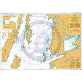
NOAA Nautical Chart 16460: Igitkin ls. to Semisopochnoi Island
Price
From $24.95
See Product Details
Sale
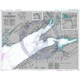
NOAA Nautical Chart 16440: Rat Islands Semisopochnoi Island to Buldir l.
Price
From $24.95
See Product Details
Sale
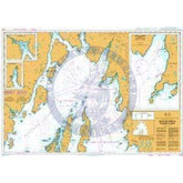
NOAA Nautical Chart 16012: Aleutian Islands Amukta Island to Attu Island
Price
From $24.95
See Product Details
Sale
New
NOAA Nautical Chart 13227: Fall River Harbor;State Pier
Sale price
$24.95
List price
$27
See Product Details
Sale
New
NOAA Nautical Chart 13225: Providence Harbor
Price
From $24.95
See Product Details
Sale
NOAA Nautical Chart 13204: Georges Bank Eastern part
Price
From $24.95
See Product Details
Sale
NOAA Nautical Chart 13203: Georges Bank Western part
Price
From $24.95
See Product Details
Sale
New
NOAA Nautical Chart 12374: North Shore of Long Island Sound Duck Island to Madison Reef
Price
From $24.95
See Product Details
Sale
New
NOAA Nautical Chart 12373: North Shore of Long Island Sound Guilford Harbor to Farm River
Price
From $24.95
See Product Details
Sale
New
NOAA Nautical Chart 12342: Harlem River
Price
From $24.95
See Product Details
Sale
New
NOAA Nautical Chart 12337: Passaic and Hackensack Rivers
Price
From $24.95
See Product Details