


Fast and reliable service. Excellent
Shopping, ordering and delivery outstanding. Acta non Verba always delivers.
Quick delivery
British Admiralty Nautical Chart 1791: Caledonian Canal
Good Service and fast delivery.


Usually ready in 24 hours
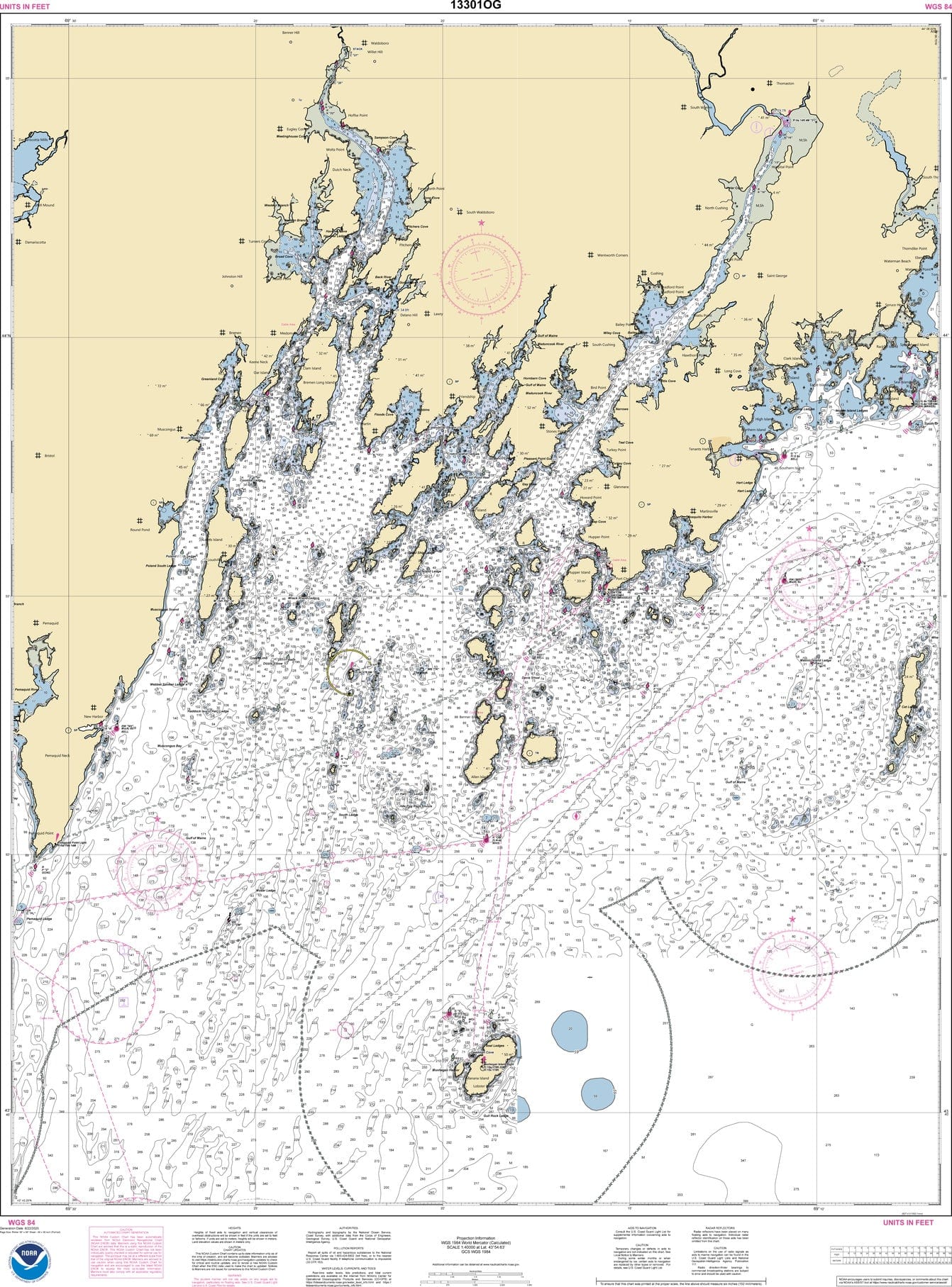
NOAA Nautical Chart 13301: Muscongus Bay; New Harbor; Thomaston is a standard navigation chart used by commercial and recreational mariners alike. Printed on-demand on water-resistant paper, this chart meets the definition of a nautical chart in SOLAS Chapter V Regulation 2.2 and satisfies carriage requirements in SOLAS Chapter V Regulation 19.2.1.4.
Available Versions
1. NOAA Custom Chart (For Navigation)
2. NOAA Traditional Chart (Not for Navigation)
Printing & Material
NOAA Custom Chart (Updated)
Scale: 40000
Paper Size: 36.0" x 47.0"
Actual Chart Size: 33.5" x 45.4"
Traditional NOAA Chart (Sunsetted)
Scale: 40,000
Paper Size: 36.0" x 48.0"
Actual Chart Size: 33.8" x 44.5"
Edition #: 22
Edition Date: 2018-12-01
Farewell to Traditional Nautical Charts
NOAA nautical charts are simply the best. They have been around for years and are tried and true. Useful, of course, but quite attractive too.
Phone: +1 954-522-3321
Whatsapp: +1 954-292-4212
E-mail: sales@amnautical.com
Review us on Google!
American Nautical Services, Inc.
3311 S Andrews Ave, Suite 11
Fort Lauderdale, FL 33316
United States of America
Mon-Fri 8am-5pm - Sat. 9am-5pm
Fast and reliable service. Excellent
Shopping, ordering and delivery outstanding. Acta non Verba always delivers.
Quick delivery
British Admiralty Nautical Chart 1791: Caledonian Canal
Good Service and fast delivery.