The TimeZero TZ Map: Japan delivers comprehensive navigational coverage for an archipelago nation that ranks among the world’s largest maritime economies, comprising over 6,800 islands with a coastline exceeding 29,000 kilometers and hosting some of the densest commercial shipping traffic on earth. Built on the advanced TZ Maps platform developed by TimeZero, this chart pack integrates multiple chart types, official hydrographic raster charts, detailed vector data, high-resolution bathymetric data, and satellite imagery into a single navigational package supporting safe passage through waters where commercial port complexity, narrow strait transits, and concentrated fishing fleet activity create a navigation environment that demands continuous situational awareness.
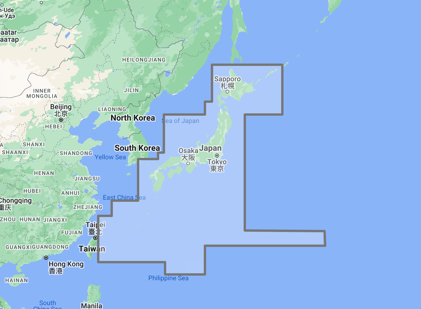
Coverage encompasses the full Japanese archipelago from the northern island of Hokkaido through Honshu, Shikoku, and Kyushu to the Ryukyu island chain extending south to Okinawa and beyond. Major navigation areas include Tokyo Bay and the approaches to the ports of Tokyo, Yokohama, and Kawasaki, Ise Bay and the port of Nagoya, Osaka Bay and the Kobe-Osaka port complex, the Seto Inland Sea connecting Osaka Bay to the Strait of Shimonoseki through a 450-kilometer passage between Honshu, Shikoku, and Kyushu, the Tsugaru Strait between Honshu and Hokkaido, the Tsushima Strait between Japan and Korea, and the Pacific, Sea of Japan, and East China Sea coastlines of all major islands. This coverage area supports Japan’s position as the third-largest maritime trading nation, the extensive domestic coastal shipping network, the commercial fishing industry operating from hundreds of ports, and the recreational boating and yacht cruising community active throughout the archipelago.
Raster data within the TZ Map is georeferenced, featuring digital images of official charts from the Japan Coast Guard Hydrographic and Oceanographic Department (JHOD), the national agency responsible for charting Japanese navigable waters. JHOD maintains one of the most comprehensive national chart programs in Asia, with intensively surveyed commercial port approaches, strait passages, and Inland Sea channels reflecting Japan’s enormous commercial maritime traffic volume. Vector data complements raster imagery with a layered database recording every nautical feature, delivering queryable depth information, traffic separation scheme boundaries, anchorage zone designations, and navigational object data across the full coverage area.
The BathyVision feature provides dynamic 3D bottom data display essential for navigating the narrow strait passages between Japanese islands, the complex channel network of the Seto Inland Sea, the deep-water approaches to Tokyo Bay, where the continental shelf drops steeply, and the coral reef approaches of the Ryukyu islands. Tidal currents through the Naruto Strait between Shikoku and Awaji Island can exceed 13 knots, creating whirlpool conditions that demand precise navigation timing, and the Kanmon Strait connecting the Inland Sea to the open Sea of Japan presents one of the highest-traffic confined waterways in the world. High-definition satellite imagery options are available for selected port areas and popular anchorages.
Compatible with TimeZero Navigator v5, TimeZero Professional v5, and Furuno NavNet TZtouch4 (sold separately).
Overview
Feature Highlights Strip
Navigate with integrated raster and vector chart data sourced from official hydrographic offices and enriched with detailed nautical features.
Visualize bottom structure with high-resolution bathymetry and BathyVision 3D contour mapping for strait, inland sea, and harbor approach navigation.
Overlay satellite photography with chart data for realistic visual identification of ports, anchorages, and coastal landmarks.
View realistic shoreline altimetry and perspective horizons to identify port entries and channel approaches from offshore.
Customize chart display by toggling between raster imagery, vector layers, bathymetric overlays, and satellite views within TimeZero software.
Compatible with TimeZero Navigator v5, TimeZero Professional v5, and Furuno NavNet TZtouch4 for recreational and professional navigation.
High-Resolution Bathymetry
Navigate Strait Passages, Inland Sea Channels, and Bay Approaches with Confidence
High-resolution bathymetric data transforms chart contour lines into intuitive 3D bottom representations, providing essential depth awareness when navigating into Japanese ports, strait passages, and the island-studded channels of the Seto Inland Sea. The graphic interpretation of contour data creates detailed bottom profiles invaluable for approach planning and transit routing in waters where concentrated commercial traffic shares confined channels with fishing vessels, ferries, and recreational boats.
The BathyVision feature displays bottom topography in color and contour line overlays, allowing mariners to dynamically adjust the visualization to suit their navigation needs. This capability is particularly critical across Japanese waters, where the Seto Inland Sea presents a 450-kilometer navigation corridor threading between over 700 islands, with narrow channels, bridge clearance restrictions, strong tidal currents, and commercial traffic density that ranks among the highest in any enclosed waterway worldwide, Tokyo Bay approaches involve deep-draft vessel routing through established traffic lanes converging on the ports of Tokyo, Yokohama, Kawasaki, and Chiba, where under-keel clearance management is critical for large commercial vessels, the Naruto Strait generates tidal currents exceeding 13 knots and creates the famous Naruto whirlpools, requiring precise transit timing calculated against tidal predictions for safe passage, and the Ryukyu island chain from Okinawa southward presents coral reef approaches where shallow fringing reefs extend offshore with limited channel width between reef edges.
Mariners transiting the Kanmon Strait, navigating the Seto Inland Sea traffic routes, approaching the Uraga Channel into Tokyo Bay, or threading the reef passages of Okinawa benefit from bottom structure visualization that flat chart views cannot replicate.
Raster and Vector Chart Fusion
Official Charts Enhanced with Intelligent Data Layers
TZ Maps combines two complementary chart formats to deliver maximum navigational confidence. Georeferenced raster data presents true-color digital copies of official JHOD charts, the authoritative cartographic record for Japanese navigable waters. These images provide a reliable visual reference preserving the Japanese chart symbology, bilingual notation conventions, and tidal current information that mariners navigating these waters depend upon.
Vector data operates alongside raster imagery using a database-driven approach that stores information in discrete layers and records every nautical feature independently. This format enables interactive chart queries, object-based search, and depth value interrogation that static raster imagery cannot provide. Across Japanese waters, where vessel traffic service zones, mandatory reporting areas, submarine cable routes, military exercise areas, fishery zones, and bridge clearance restrictions create extremely dense regulatory overlays, particularly concentrated in the Seto Inland Sea and major bay approaches, the ability to query and filter individual chart objects provides critical operational value for both commercial navigation planning and recreational passage preparation.
JHOD chart coverage reflects Japan’s status as a leading maritime nation, with comprehensive survey data across commercial shipping routes, port approaches, and high-traffic strait passages. TZ Maps integrates this authoritative dataset with enriched vector layers, delivering seamless coverage from the ice-affected waters of northern Hokkaido to the subtropical reef-lined coast of Okinawa.
Satellite Photo Overlay
See the Real Landscape Behind the Chart
TZ Maps fuses satellite photography with raster and vector chart data, presenting only the visual information essential for safe navigation. Standard-resolution satellite images are included in every TZ Maps data pack, with high-definition options available for selected areas.
This overlay capability proves especially valuable across Japan, where visual identification of harbor breakwaters, marina positions, and port entrances against densely developed coastal urban areas aids safe approach navigation. Mariners arriving at ports within the Tokyo Bay or Osaka Bay complexes, where industrial infrastructure extends for kilometers along the waterfront, distinguishing fishing harbor entrances along the developed coastline of the Seto Inland Sea, or identifying reef pass approaches in Okinawa, can correlate chart data with actual terrain appearance before committing to the final approach. Along the more remote coastlines of northern Honshu and Hokkaido, where fishing ports are the primary harbor infrastructure between major commercial centers, satellite overlay provides visual confirmation of port positions against undeveloped shoreline.
Realistic Shoreline Views
Identify Port Entries and Coastal Features from the Horizon
TZ Maps employs altimetry to render shorelines with realistic elevation perspective, creating 3D views that simulate the visual horizon as seen from the bridge. This perspective rendering aids instant identification of port entrances, strait openings, and specific shoreline landmarks during approach.
Japan presents varied coastal profiles across its volcanic archipelago. The mountainous coastlines of Shikoku and western Honshu rise steeply from the Inland Sea, providing bold visual landmarks but with dozens of similar-appearing bays and harbor entrances between major ports. The flat alluvial plains surrounding Tokyo Bay and Ise Bay create low-lying industrial coastlines where port entrances must be identified by infrastructure rather than terrain. The volcanic Ryukyu Islands present tropical profiles ringed by reefs. Hokkaido’s northern coast combines high terrain with fog conditions that can reduce visibility to near zero. Altimetric rendering provides visual previews calibrated to actual terrain elevation for all of these profiles, helping mariners confirm their approach, whether navigating the crowded Inland Sea or making landfall on a remote Hokkaido fishing port in limited visibility.
Detailed Land Information
Understand the Coastline and Nearby Infrastructure
Beyond waterway navigation data, TZ Maps integrates detailed land information that enhances understanding of coastlines and nearby infrastructure. Road networks, settlement locations, and coastal facility positions are rendered alongside maritime chart data.
This integrated land detail supports voyage planning across Japan, where the concentration of marine services is exceptionally high by global standards. Japan’s extensive network of fishing ports, commercial harbors, and marina facilities means fuel, provisions, and basic repair services are available at relatively frequent intervals along most of the coastline. However, understanding which ports offer customs clearance for international arrivals, which have marina facilities versus exclusively commercial or fishing infrastructure, and which provide the draft clearance and berth dimensions needed for larger vessels requires the kind of advance planning that integrated land and maritime data supports.
Software Compatibility
Purpose-Built for TimeZero Navigation Software
The TZ Map: Japan is designed for use with TimeZero navigation software platforms and compatible Furuno hardware. Compatible applications include:
TimeZero Navigator v5: Full-featured navigation software for recreational and professional mariners
TimeZero Professional v5: Advanced navigation platform with commercial vessel capabilities
Furuno NavNet TZtouch4: Integrated chartplotter hardware with native TZ Maps support
TZ Maps are delivered as data packs that load directly into compatible software and hardware installations. Mariners using Garmin, Raymarine, Simrad, or other chartplotter platforms should consult the ANS digital charts catalog for compatible chart products.
Complete Setup
TimeZero Navigation Software
TZ Maps require compatible TimeZero software or Furuno hardware. TimeZero, headquartered in Japan, develops its navigation software with deep integration into Japanese maritime operations. Choose TimeZero Navigator v5 for recreational cruising or TimeZero Professional v5 for advanced commercial navigation features.
Additional TZ Map Regions
Extend coverage with other TZ Map: Australia and TZ Map: New Zealand packs for vessels operating beyond Japanese waters. Multiple TZ Map packs load seamlessly within the same TimeZero software installation.
Japan Cruising Guides
Supplement digital chart data with anchorage descriptions, approach instructions, and local facility information from dedicated Japan cruising guides available through ANS.
ADMIRALTY Paper Charts: Japanese Waters
Commercial vessels subject to SOLAS chart carriage requirements should maintain official paper chart backup for primary navigation areas. ADMIRALTY charts covering the Western Mediterranean are available through the ANS Chart Selector.
Need Help Choosing the Right Charting Solution?
Phone: +1 (954) 522-3321
WhatsApp: +1 (954) 292-4212
Email: sales@amnautical.com
Hours: Mon-Fri 8 am-5 pm | Sat 9 am-5 pm EST
FAQs
Q1. What areas does the TZ Map: Japan cover?
Coverage includes the full Japanese archipelago from Hokkaido to the Ryukyu Islands and Okinawa, the Seto Inland Sea, Tokyo Bay, Ise Bay, Osaka Bay, the Tsugaru and Tsushima Straits, and the Pacific, Sea of Japan, and East China Sea coastlines of all major islands.
Q2. What software and hardware is this TZ Map compatible with?
Compatible with TimeZero Navigator v5, TimeZero Professional v5, and Furuno NavNet TZtouch4.
Q3. Can TZ Maps be used for SOLAS chart carriage compliance?
TZ Maps are designed for navigation planning and situational awareness. Contact ANS for guidance on SOLAS-compliant chart solutions for Japanese waters.
Q4. What chart data types are included in the TZ Map pack?
Each pack integrates georeferenced raster charts (official JHOD imagery), vector chart data, high-resolution bathymetry with BathyVision 3D display, satellite photography overlay, and detailed land information.
Q5. Can multiple TZ Map regions be used simultaneously?
Yes. Multiple TZ Map data packs can be installed within the same TimeZero software environment, providing seamless coverage transitions when navigating between regions.
Q6. How does the Seto Inland Sea affect navigation planning?
The 450-kilometer Inland Sea passage between over 700 islands involves narrow channels, strong tidal currents, bridge clearance restrictions, and some of the highest commercial traffic density in any enclosed waterway worldwide. Accurate chart data with depth visualization and regulatory overlay query capability is essential for safe Inland Sea transit planning. The Naruto Strait alone generates tidal currents exceeding 13 knots.
Order placement and pickup was efficient and easy! I made an order mistake and they fixed it quickly for me. Hal was such a pleasure to talk to as well. Product is as described. Thanks!
My wife and I are still a few years away from casting off the dock lines on this journey, but Skipper Bob's insights have really framed my thinking about the Big Picture. I burned through the book in just a few days and have already changed some of our early planning based on the information I gleaned.
Thanks to all of you for keeping this valuable resource readily available!