The TimeZero TZ Map: Canada East & North delivers comprehensive navigational coverage for the vast eastern and northern Canadian coastline, a maritime region spanning temperate fishing grounds, one of the world’s great commercial waterways, and some of the most remote and ice-affected waters accessible to recreational and commercial vessels. Built on the advanced TZ Maps platform developed by TimeZero, this chart pack integrates multiple chart types, official hydrographic raster charts, detailed vector data, high-resolution bathymetric data, and satellite imagery into a single navigational package supporting safe passage through Canadian waters that present navigational challenges ranging from dense fog and extreme tidal ranges to seasonal ice coverage and Arctic isolation.
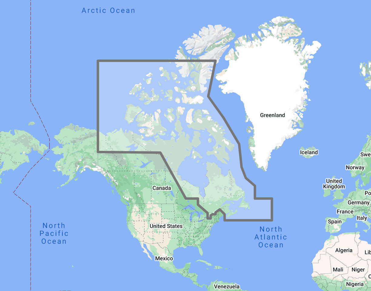
Coverage encompasses the full Atlantic Canadian coastline from the Bay of Fundy and Nova Scotia through New Brunswick, Prince Edward Island, and the Gulf of St. Lawrence, the St. Lawrence River corridor from the Gulf upstream through the commercially critical shipping channel to Montreal, the island of Newfoundland and the Strait of Belle Isle, the Labrador coast extending northward into the sub-Arctic, Hudson Bay and Hudson Strait, and the Canadian Arctic archipelago including Baffin Island, the Northwest Passage approaches, and the high Arctic islands. This coverage area supports the concentrated commercial traffic of the St. Lawrence Seaway system, the fishing fleets operating on the Grand Banks and Scotian Shelf, the growing expedition cruise traffic in Labrador and the Arctic, and the recreational sailing community concentrated in the Maritimes and the Thousand Islands region.
Raster data within the TZ Map is georeferenced, featuring digital images of official charts from the Canadian Hydrographic Service (CHS), the national agency responsible for charting all Canadian navigable waters. CHS maintains chart coverage ranging from the intensively surveyed St. Lawrence shipping channel to the remote Arctic waters where survey data may date from early exploration-era soundings. Vector data complements raster imagery with a layered database recording every nautical feature, delivering queryable depth information and navigational object data across the full coverage area. In regions where CHS survey coverage is sparse, vector data layers provide supplementary navigational information that extends situational awareness beyond the limits of official chart detail.
The BathyVision feature provides dynamic 3D bottom data display essential for navigating the deep fjord approaches of Labrador, the shallow tidal flats of the Bay of Fundy, the dredged commercial channels of the St. Lawrence, and the rock-bound harbors that line the Nova Scotia and Newfoundland coasts. High-definition satellite imagery options are available for selected port areas and popular anchorages.
Compatible with TimeZero Navigator v5, TimeZero Professional v5, and Furuno NavNet TZtouch4 (sold separately).
Overview
Feature Highlights Strip
Navigate with integrated raster and vector chart data sourced from official hydrographic offices and enriched with detailed nautical features.
Visualize the bottom structure with high-resolution bathymetry and BathyVision 3D contour mapping.
Overlay satellite photography with chart data.
View realistic shoreline altimetry and perspective horizons.
Customize chart display by toggling layers.
Compatible with TimeZero Navigator v5 and Professional v5.
High-Resolution Bathymetry
Navigate Extreme Tides, River Channels, and Arctic Approaches with Confidence
High-resolution bathymetric data transforms chart contour lines into intuitive 3D bottom representations, providing essential depth awareness when navigating into Canadian ports, tidal harbors, river channels, and the ice-affected coastal approaches of Labrador and the Arctic. The graphic interpretation of contour data creates detailed bottom profiles invaluable for approach planning and transit timing in waters where tidal ranges, seasonal ice, and limited survey coverage combine to create navigation environments that demand every available data advantage.
The BathyVision feature displays bottom topography in color and contour line overlays, allowing mariners to dynamically adjust the visualization to suit their navigation needs. This capability is particularly critical across eastern and northern Canada, where the Bay of Fundy produces the highest tidal ranges in the world, exceeding 16 meters at the head of the bay, transforming the navigable landscape between high and low water and creating tidal bore conditions in tributary rivers, the St. Lawrence River shipping channel from Quebec City to Montreal involves a 300-kilometer transit through a dredged fairway where commercial vessel under-keel clearance is managed against river level fluctuations, seasonal water levels, and current-driven depth variations, the Newfoundland and Labrador coasts present rock-bound harbor approaches where submerged ledges, fishing gear hazards, and limited aids to navigation characterize many working harbors, and the Canadian Arctic archipelago features uncharted or minimally surveyed passages where expedition vessels rely on every available depth data source to supplement official chart information that may reflect surveys conducted decades or centuries ago.
Mariners entering Halifax harbor, transiting the Canso Strait, navigating the St. Lawrence pilotage district, approaching outport harbors along the Newfoundland coast, or planning expedition routes through the Labrador fjords and Arctic channels benefit from bottom structure visualization that flat chart views cannot replicate.
Raster and Vector Chart Fusion
Official Charts Enhanced with Intelligent Data Layers
TZ Maps combines two complementary chart formats to deliver maximum navigational confidence. Georeferenced raster data presents true-color digital copies of official Canadian Hydrographic Service charts, the authoritative cartographic record for all Canadian navigable waters. These images provide a reliable visual reference that experienced navigators can interpret immediately, maintaining the familiar CHS chart symbology, depth notation conventions, and tidal reference systems.
Vector data operates alongside raster imagery using a database-driven approach that stores information in discrete layers and records every nautical feature independently. This format enables interactive chart queries, object-based search, and depth value interrogation that static raster imagery cannot provide. Across eastern and northern Canadian waters, where regulated areas include vessel traffic service zones, marine protected areas, fisheries closure zones, military exercise areas, and ice navigation advisory regions, the ability to query and filter individual chart objects supports navigation planning that accounts for the full regulatory and environmental overlay.
The CHS chart program spans an extraordinary range of survey quality and vintage. St. Lawrence shipping channel charts reflect recent multibeam survey data with meter-level accuracy. Arctic charts may incorporate soundings from 19th-century exploration voyages supplemented by limited modern spot checks. TZ Maps integrates this entire spectrum into a seamless navigational package while vector data layers provide supplementary depth and feature information that helps mariners assess the reliability and density of available chart data in each area, a critical capability when planning passages through waters where chart adequacy itself is a navigation risk factor.
Satellite Photo Overlay
See the Real Landscape Behind the Chart
TZ Maps fuses satellite photography with raster and vector chart data, presenting only the visual information essential for safe navigation. Standard-resolution satellite images are included in every TZ Maps data pack, with high-definition options available for selected areas.
This overlay capability proves especially valuable across eastern and northern Canada, where visual identification of harbor breakwaters, wharf positions, and anchorage locations against rugged and often undeveloped coastlines aids safe approach navigation. Mariners arriving at Nova Scotia fishing harbors where wharves and breakwaters may be the only man-made features visible against a forested shoreline, identifying approaches to Newfoundland outport communities, or locating suitable anchorage positions along the Labrador coast where no formal harbor infrastructure exists, can correlate chart data with actual terrain appearance before committing to the final approach. In the Arctic, where charted features may be minimal, and the coastline presents a uniform appearance of rock, ice, and tundra, satellite overlay provides visual context that supports landfall identification across vast stretches of otherwise featureless terrain.
Realistic Shoreline Views
Identify Port Entries and Coastal Features from the Horizon
TZ Maps employs altimetry to render shorelines with realistic elevation perspective, creating 3D views that simulate the visual horizon as seen from the bridge. This perspective rendering aids instant identification of port entrances, fjord openings, and specific shoreline landmarks during approach.
Eastern and northern Canada present coastal profiles ranging from the low-lying dunes of Prince Edward Island and the Magdalen Islands to the towering fjord walls of Labrador and Baffin Island. The Nova Scotia and Newfoundland coasts combine rocky headlands with deep bays and harbors that can be difficult to distinguish from seaward until close approach. The Labrador and Arctic coastlines present vast, high-relief terrain where fjord entrances may be the only navigable features along hundreds of kilometers of continuous cliff face. Altimetric rendering provides visual previews calibrated to actual terrain elevation for all of these profiles, helping mariners distinguish a harbor entrance from an adjacent blind bay, whether approaching the gentle coastline of the Gulf of St. Lawrence or making landfall against the granite walls of a Labrador fjord.
Detailed Land Information
Understand the Coastline and Nearby Infrastructure
Beyond waterway navigation data, TZ Maps integrates detailed land information that enhances understanding of coastlines and nearby infrastructure. Road networks, settlement locations, and coastal facility positions are rendered alongside maritime chart data.
This integrated land detail is essential across eastern and northern Canada, where the concentration of marine services varies dramatically between the well-equipped ports of Halifax, St. John’s, and Montreal, and the remote coastlines of Labrador and the Arctic, where fuel, repair facilities, and even basic provisioning may be unavailable for hundreds of nautical miles. Understanding which communities have road access, which rely entirely on marine or air supply, and which offer emergency medical facilities supports the kind of contingency planning that responsible passage-making through remote Canadian waters demands.
Software Compatibility
Purpose-Built for TimeZero Navigation Software
The TZ Map: Canada East & North is designed for use with TimeZero navigation software platforms and compatible Furuno hardware. Compatible applications include:
TimeZero Navigator v5: Full-featured navigation software for recreational and professional mariners
TimeZero Professional v5: Advanced navigation platform with commercial vessel capabilities
Furuno NavNet TZtouch4: Integrated chartplotter hardware with native TZ Maps support
TZ Maps are delivered as data packs that load directly into compatible software and hardware installations. Mariners using Garmin, Raymarine, Simrad, or other chartplotter platforms should consult the ANS digital charts catalog for compatible chart products, including Navionics and C-MAP options available through ANS.
Need assistance determining the right chart format for your bridge electronics? Contact the ANS navigation team for personalized guidance on matching chart products to your vessel equipment.
Complete Setup
Complete Your Canadian Waters Navigation Setup
TimeZero Navigation Software
TZ Maps require compatible TimeZero software or Furuno hardware. Choose TimeZero Navigator v5 for recreational cruising, TimeZero Professional v5 for advanced commercial navigation, or confirm Furuno NavNet TZtouch4 compatibility for integrated bridge systems.
Additional TZ Map Regions
Combine with TZ Map: North America | USA for seamless coverage from the Canadian Maritimes south through the entire U.S. coastline. Add TZ Map: Great Lakes for the inland waterway system, TZ Map: Bahamas for vessels continuing south from Florida, or TZ Map: Iceland | Greenland for North Atlantic crossings from Newfoundland or Labrador. Multiple TZ Map packs load seamlessly within the same TimeZero software installation.
Canadian Waters Cruising Guides
Supplement digital chart data with detailed anchorage descriptions, approach instructions, ice season timing, and local facility information from dedicated Nova Scotia, Newfoundland, and St. Lawrence cruising guides available through ANS.
ADMIRALTY and CHS Paper Charts
Commercial vessels subject to SOLAS chart carriage requirements should maintain official chart backup for primary navigation areas. ADMIRALTY and CHS charts covering eastern and northern Canadian waters are available through the ANS Chart Selector.
Need Help Choosing the Right Charting Solution?
The ANS navigation team provides personalized guidance on chart selection, software compatibility, and compliance requirements for vessels of all types. Whether outfitting a yacht for a Maritimes coastal cruise or equipping an expedition vessel for Labrador and Arctic passages, ANS specialists match chart products to your vessel, cruising plans, and bridge electronics.
Phone: +1 (954) 522-3321
WhatsApp: +1 (954) 292-4212
Email: sales@amnautical.com
Hours: Mon-Fri 8 am-5 pm | Sat 9 am-5 pm EST
FAQs
Q1. What areas does the TZ Map: Canada East & North cover?
This chart pack provides navigational coverage for the full Atlantic Canadian coastline from the Bay of Fundy through Nova Scotia, New Brunswick, Prince Edward Island, and the Gulf of St. Lawrence, the St. Lawrence River corridor to Montreal, Newfoundland and the Strait of Belle Isle, the Labrador coast, Hudson Bay and Hudson Strait, and the Canadian Arctic archipelago including Baffin Island and the Northwest Passage approaches.
Q2. What software and hardware is this TZ Map compatible with?
This TZ Map is compatible with TimeZero Navigator v5, TimeZero Professional v5, and Furuno NavNet TZtouch4. It does not operate on standalone chartplotters from Garmin, Raymarine, Simrad, or other manufacturers.
Q3. Can TZ Maps be used for SOLAS chart carriage compliance?
TZ Maps are designed for navigation planning and situational awareness. Vessels subject to SOLAS Chapter V carriage requirements should verify that their chart products and navigation equipment meet applicable flag state standards. Contact ANS for guidance on SOLAS-compliant chart solutions for Canadian waters.
Q4. What chart data types are included in the TZ Map pack?
Each TZ Map pack integrates georeferenced raster charts (official Canadian Hydrographic Service imagery), vector chart data, high-resolution bathymetry with BathyVision 3D display, satellite photography overlay, and detailed land information, including coastline features and infrastructure.
Q5. Can multiple TZ Map regions be used simultaneously?
Multiple TZ Map data packs can be installed within the same TimeZero software environment, providing seamless coverage transitions when navigating between regions. Combining the Canada East & North pack with TZ Map: North America | USA provides continuous coverage from the Canadian Arctic south through the entire U.S. coastline.
Q6. How reliable is chart coverage in the Canadian Arctic?
Chart quality in the Canadian Arctic varies significantly. CHS charts for established shipping corridors and major settlements reflect modern survey standards, while charts for remote passages may incorporate historical soundings from early exploration voyages with limited modern verification. Mariners planning Arctic passages should assess chart adequacy as part of their voyage risk assessment and consult CHS Notices to Mariners for the latest survey information and chart corrections.
Order placement and pickup was efficient and easy! I made an order mistake and they fixed it quickly for me. Hal was such a pleasure to talk to as well. Product is as described. Thanks!
My wife and I are still a few years away from casting off the dock lines on this journey, but Skipper Bob's insights have really framed my thinking about the Big Picture. I burned through the book in just a few days and have already changed some of our early planning based on the information I gleaned.
Thanks to all of you for keeping this valuable resource readily available!