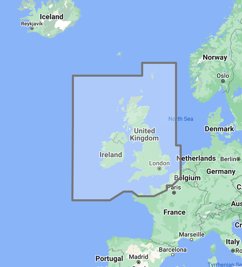
Timezero TZ Map: UK, Ireland & the English Channel
Price
$300
No reviews
The TimeZero TZ Map: British Islands, Ireland, English Channel delivers comprehensive navigational coverage for one of the most demanding and historically significant maritime regions in the world. Built on the advanced TZ Maps platform developed by TimeZero, this chart pack integrates multiple chart types, official hydrographic raster charts, detailed vector data, high-resolution bathymetric data, and satellite imagery into a single navigational package supporting safe passage through waters defined by extreme tidal ranges, dense commercial traffic, and a coastline of extraordinary navigational complexity.
Coverage encompasses the entire coastline of England, Scotland, Wales, and Northern Ireland, the Republic of Ireland, the English Channel from the Dover Strait to the Western Approaches, the Irish Sea, the Bristol Channel, the North Sea western margins, the Scottish islands including the Hebrides, Orkney, and Shetland, and the Channel Islands. This region hosts the busiest shipping lane in the world through the Dover Strait, major commercial ports including London, Southampton, Liverpool, Dublin, and Glasgow, and some of the most active recreational sailing waters in Europe, concentrated in the Solent, the Thames Estuary, the Scottish west coast, and the southwest English coast.
Raster data within the TZ Map is georeferenced, featuring digital images of official charts from the United Kingdom Hydrographic Office (UKHO), the producer of the world-renowned ADMIRALTY chart series, and supplementary data from the Marine Institute of Ireland and other regional hydrographic authorities. The UKHO maintains one of the most comprehensive and meticulously updated national chart programs globally, and TZ Maps delivers this data in its original published format alongside enriched vector layers. Vector data complements raster imagery with a layered database recording every nautical feature, delivering queryable depth information, traffic separation scheme boundaries, tidal diamond positions, and navigational object data across the full coverage area.
The BathyVision feature provides a dynamic 3D bottom data display essential for navigating the tide-scoured channels, shallow estuary approaches, and sandbank-lined coastal passages that characterize British and Irish waters. Tidal ranges exceeding 10 meters in the Bristol Channel and Severn Estuary, combined with fast-running tidal streams through narrow passages such as the Needles Channel, Portland Race, and the Menai Strait, make accurate depth awareness at every state of tide a fundamental safety requirement rather than a convenience. High-definition satellite imagery options are available for selected port areas and popular anchorages.
Compatible with TimeZero Navigator v5 and TimeZero Professional v5 software (sold separately).
Overview
Feature Highlights Strip
Navigate with integrated raster and vector chart data sourced from official hydrographic offices and enriched with detailed nautical features.
Visualize the bottom structure with high-resolution bathymetry and BathyVision 3D contour mapping.
Overlay satellite photography with chart data.
View realistic shoreline altimetry and perspective horizons.
Customize chart display by toggling layers.
Compatible with TimeZero Navigator v5 and Professional v5.
High-Resolution Bathymetry
Navigate Tidal Waters with Confidence
High-resolution bathymetric data transforms chart contour lines into intuitive 3D bottom representations, providing essential depth awareness when navigating into British and Irish ports, tidal estuaries, and coastal passages where available water depth changes dramatically with every tide cycle. The graphic interpretation of contour data creates detailed bottom profiles invaluable for approach planning and passage timing in waters where the difference between a safe transit and a grounding can be measured in hours rather than miles.
The BathyVision feature displays bottom topography in color and contour line overlays, allowing mariners to dynamically adjust the visualization to suit their navigation needs. This capability is particularly critical around the British Islands, where the Thames Estuary, Wash, and East Anglian coast present extensive shallow sandbank systems that shift seasonally and require continuous depth monitoring, the Solent and its approaches involve narrow channels between drying banks where tidal timing dictates safe passage windows, the Bristol Channel and Severn Estuary create tidal ranges exceeding 10 meters, transforming the navigable landscape between high and low water, and the west coasts of Scotland and Ireland present rock-bound approaches where submerged reefs line the entrances to otherwise sheltered anchorages.
Mariners entering the Solent through the Needles Channel, navigating the Thames Estuary shipping lanes, transiting the Menai Strait between Anglesey and the Welsh mainland, or approaching anchorages along the Scottish west coast benefit from bottom structure visualization that flat chart views cannot replicate. In tidal waters of this magnitude, understanding what the seabed looks like is inseparable from understanding when it is safe to be there.
Raster and Vector Chart Fusion
Official Charts Enhanced with Intelligent Data Layers
TZ Maps combines two complementary chart formats to deliver maximum navigational confidence. Georeferenced raster data presents true-color digital copies of official UKHO ADMIRALTY paper charts, the global benchmark for nautical cartography, relied upon by commercial and recreational mariners worldwide. These images provide a reliable visual reference that experienced navigators can interpret immediately, with the distinctive ADMIRALTY chart style, symbology, and tidal diamond system intact.
Vector data operates alongside raster imagery using a database-driven approach that stores information in discrete layers and records every nautical feature independently. This format enables interactive chart queries, object-based search, and depth value interrogation that static raster imagery cannot provide. In British waters, where traffic separation schemes, precautionary areas, anchorage zones, military exercise areas, and renewable energy installations create dense regulatory overlays on top of physical navigation challenges, the ability to query and filter individual chart objects provides significant operational value.
The coverage area benefits from the UKHO’s systematic chart maintenance program, with corrections issued through weekly ADMIRALTY Notices to Mariners. TZ Maps integrates this authoritative national dataset with enriched vector layers, delivering consistent navigation coverage from the Dover Strait to the Shetland Islands without the folio management burden of maintaining separate chart sets for the English Channel, Irish Sea, North Sea, and Scottish waters.
Satellite Photo Overlay
See the Real Landscape Behind the Chart
TZ Maps fuses satellite photography with raster and vector chart data, presenting only the visual information essential for safe navigation. Standard-resolution satellite images are included in every TZ Maps data pack, with high-definition options available for selected areas.
This overlay capability proves especially valuable around the British Islands, where visual identification of harbor breakwaters, marina entrances, and river mouths against complex urban and industrial coastlines aids safe approach navigation. Mariners arriving at unfamiliar harbors along the English south coast, distinguishing marina entrances in the Solent from adjacent boatyard facilities, identifying the correct estuary channel on the East Anglian coast, or approaching the numerous small harbors of the Scottish west coast can correlate chart data with actual terrain appearance before committing to the final approach. In the English Channel, where the French coast is visible from the English shore on clear days but individual port approaches remain difficult to resolve from offshore, satellite overlay provides the visual confirmation that supports confident landfall navigation.
Realistic Shoreline Views
Identify Port Entries and Coastal Features from the Horizon
TZ Maps employs altimetry to render shorelines with realistic elevation perspective, creating 3D views that simulate the visual horizon as seen from the bridge. This perspective rendering aids instant identification of port entrances, channel openings, and specific shoreline landmarks during approach.
The British Islands present dramatically varied coastal profiles. The chalk cliffs of Dover and the Seven Sisters provide unmistakable high-relief landmarks, while the low-lying estuarine coasts of Essex, Suffolk, and the Wash present minimal visual profile from offshore. The Scottish Highlands and the west coast of Ireland rise steeply, with multiple sea lochs and bay entrances that can appear similar from seaward. Altimetric rendering addresses all of these profiles by providing realistic visual previews calibrated to actual terrain elevation, helping mariners confirm their approach, whether making landfall against dramatic clifftop scenery or searching for a river entrance along a flat marshland shore.
Detailed Land Information
Understand the Coastline and Nearby Infrastructure
Beyond waterway navigation data, TZ Maps integrates detailed land information that enhances understanding of coastlines and nearby infrastructure. Road networks, settlement locations, and coastal facility positions are rendered alongside maritime chart data.
This integrated land detail supports voyage planning around the British Islands, where mariners coordinate shoreside logistics across England, Scotland, Wales, Northern Ireland, and the Republic of Ireland. Port facility standards, fuel availability, customs requirements for non-UK arrivals, and marine service infrastructure vary considerably between major commercial ports, dedicated marinas, and the small tidal harbors that line much of the coast. Understanding which harbors offer all-tide access versus those that dry at low water, and which provide fuel, customs, and repair services, is essential context that land information layers help communicate alongside the maritime chart data.
Software Compatibility
Purpose-Built for TimeZero Navigation Software
The TZ Map: British Islands, Ireland, English Channel is designed for use with TimeZero navigation software platforms. Compatible applications include:
TimeZero Navigator v5: Full-featured navigation software for recreational and professional mariners
TimeZero Professional v5: Advanced navigation platform with commercial vessel capabilities
TZ Maps are delivered as data packs that load directly into compatible TimeZero software installations. This chart pack is not compatible with standalone chartplotters from other manufacturers. Mariners using Garmin, Raymarine, Simrad, or other hardware-based chartplotters should consult the ANS digital charts catalog for compatible chart products.
Need assistance determining the right chart format for your bridge electronics? Contact the ANS navigation team for personalized guidance on matching chart products to your vessel equipment.
Supplement digital chart data with detailed anchorage descriptions, tidal gate timing, approach instructions, and local facility information from dedicated British and Irish cruising guides available through ANS.
ADMIRALTY Paper Charts: British Islands Coverage
Commercial vessels subject to SOLAS chart carriage requirements should maintain official paper chart backup for primary navigation areas. ADMIRALTY charts covering the British Islands, English Channel, and Irish Sea are available through the ANS Chart Selector.
Need Help Choosing the Right Charting Solution?
The ANS navigation team provides personalized guidance on chart selection, software compatibility, and compliance requirements for vessels of all types. Whether outfitting a yacht for a UK circumnavigation or equipping a commercial vessel for English Channel and North Sea operations, ANS specialists match chart products to your vessel, cruising plans, and bridge electronics.
Phone: +1 (954) 522-3321
WhatsApp: +1 (954) 292-4212
Email: sales@amnautical.com
Hours: Mon-Fri 8 am-5 pm | Sat 9 am-5 pm EST
FAQs
Q1. What areas does the TZ Map: British Islands, Ireland, English Channel cover?
This chart pack provides navigational coverage for the entire coastline of England, Scotland, Wales, Northern Ireland, and the Republic of Ireland, the English Channel including the Dover Strait, the Irish Sea, the Bristol Channel, the North Sea western margins, the Scottish islands (Hebrides, Orkney, Shetland), and the Channel Islands.
Q2. What software is required to use TZ Maps?
TZ Maps require TimeZero Navigator v5 or TimeZero Professional v5 software installed on a compatible computer system. TZ Maps do not operate on standalone chartplotters from other manufacturers.
Q3. Can TZ Maps be used for SOLAS chart carriage compliance?
TZ Maps are designed for navigation planning and situational awareness. Vessels subject to SOLAS Chapter V carriage requirements should verify that their chart products and navigation equipment meet applicable flag state standards. Contact ANS for guidance on SOLAS-compliant chart solutions.
Q4. What chart data types are included in the TZ Map pack?
Each TZ Map pack integrates georeferenced raster charts (official UKHO ADMIRALTY hydrographic imagery), vector chart data, high-resolution bathymetry with BathyVision 3D display, satellite photography overlay, and detailed land information, including coastline features and infrastructure.
Q5. Can multiple TZ Map regions be used simultaneously?
Multiple TZ Map data packs can be installed within the same TimeZero software environment, providing seamless coverage transitions when navigating between regions. Combining the British Islands pack with TZ Map: Western Mediterranean supports Channel-to-Med delivery passages, while adding TZ Map: Skagerrak & Kattegat extends coverage for North Sea crossings to Scandinavia.
Order placement and pickup was efficient and easy! I made an order mistake and they fixed it quickly for me. Hal was such a pleasure to talk to as well. Product is as described. Thanks!
My wife and I are still a few years away from casting off the dock lines on this journey, but Skipper Bob's insights have really framed my thinking about the Big Picture. I burned through the book in just a few days and have already changed some of our early planning based on the information I gleaned.
Thanks to all of you for keeping this valuable resource readily available!