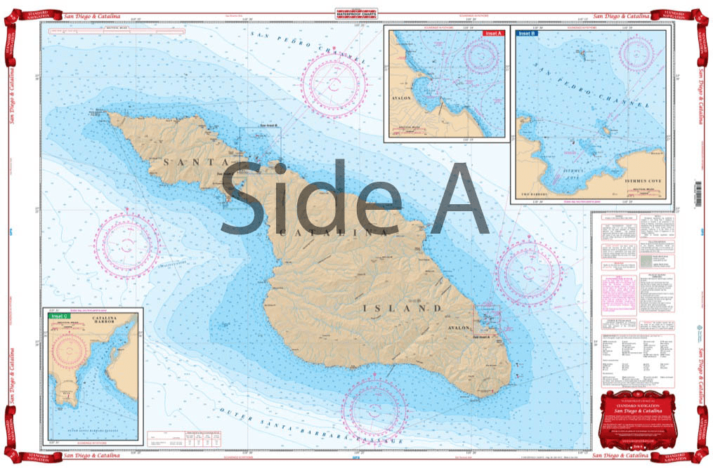
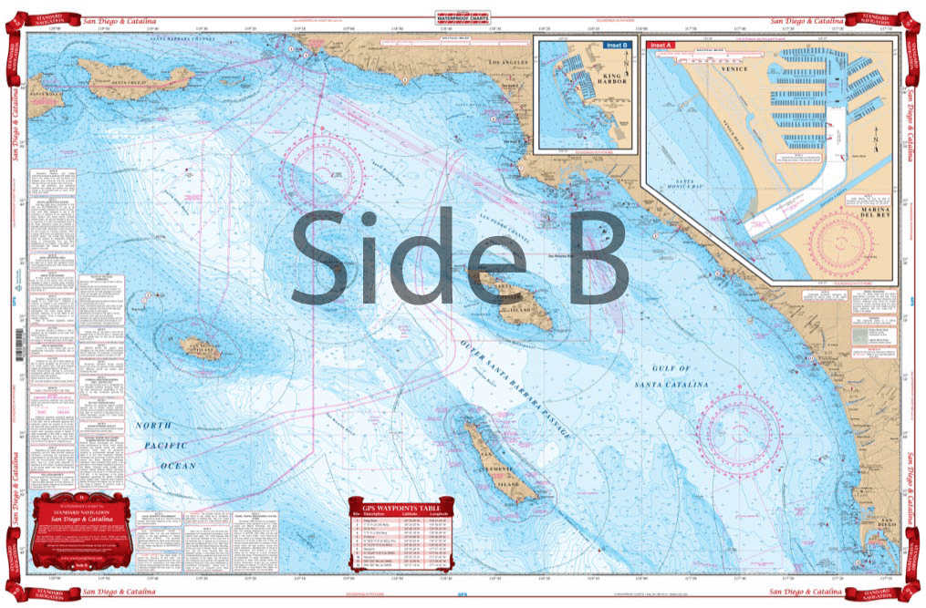
From Santa Barbara south to San Diego, this chart covers the waters offshore to San Nicholas Island with details for Santa Monica Bay and Marina Del Rey and King Harbor on one side. The reverse side details Santa Catalina Island with detailed blow ups for Isthmus Cove and Two Harbors, Avalon Bay, and Catalina Harbor. GPS Waypoints are printed directly on the chart. For journeys between San Diego and Catalina Island, this nautical map has all the detail you need. From Santa Barbara south to San Diego, this navigation chart covers the waters offshore to San Nicholas Island with details for Santa Monica Bay and Marina Del Rey and King Harbor on one side. The reverse side details Santa Catalina Island with detailed blow ups for Isthmus Cove and Two Harbors, Avalon Bay, and Catalina Harbor. GPS waypoints are printed directly on the navigation map. If you are a regular in the area, or want to remember your trip, have this navigation chart framed and display it in your home or office. Information from 3 NOAA Charts: #18740, #18744 and #18757. Nautical Chart is 25″ X 38″. WGS84 – World Mercator Datum.


Just installed the placards on my Hunter 31. They looked really good. Nice and sturdy. Not like a sheet of paper stuck to the boat!! USCG should be happy!!
excellent service and very good product recieved
The product perfectly matches what was advertised, was delivered promptly, and I was impressed not only by the quality of this map, but by the extraordinary care that ANS took to see that the product arrived safely and un-damaged. All in all these guys are very impressive, 'class-act'.
The placards looked really good on my sailboat!
Outstanding service! I accidentally ordered two of the same volumes and they followed up with me to make sure my order was correct instead of just shipping it. I would not have realized it until I received the package if they did not send me the email asking me to confirm the order. This is excellent customer service. Thank you ANS!