Double click image to zoom in

Usually ready in 24 hours
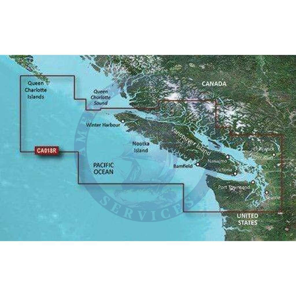
Detailed coverage of both the Inside and Outside Passages around Vancouver Island, specifically: the Strait of Juan de Fuca, the Johnstone Strait, the Strait of Georgia, the Queen Charlotte Strait, Quatsino Sound, the San Juan Islands, the Fraser River to Chilliwack, Harrison Lake, Pitt Lake, Jervis Inlet, Bute Inlet, Knight Inlet and the extreme southern portions of Hecate Island. Ports covered include Vancouver, Victoria, Sidney, Nanaimo, and Port Hardy in British Columbia, CA with Port Angeles, Oak Harbor, Anacortes and Bellingham in WA, U.S.
See your vessel’s precise, on-chart position in relation to navaids, coastal features and restricted areas with premium features found in this detailed marine mapping data. Includes all of the features of our BlueChart® g2 HD product, plus 3-D perspective above and below the waterline, Auto Guidance, high-resolution imagery, and aerial photos of ports, harbors, marinas and landmarks.

+1 954-522-3321
sales@amnautical.com
American Nautical Services, Inc.
3311 S Andrews Ave, Suite 11
Fort Lauderdale, FL 33316
United States of America
Notify me when available
We will send you a notification as soon as this product is available again.
We don't share your email with anybody


