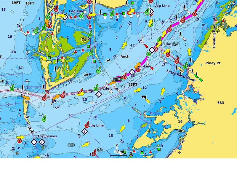
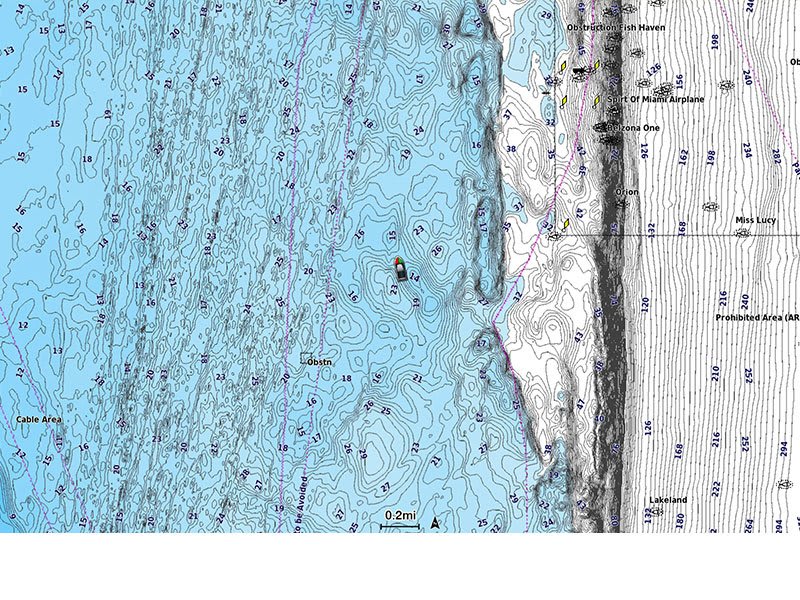
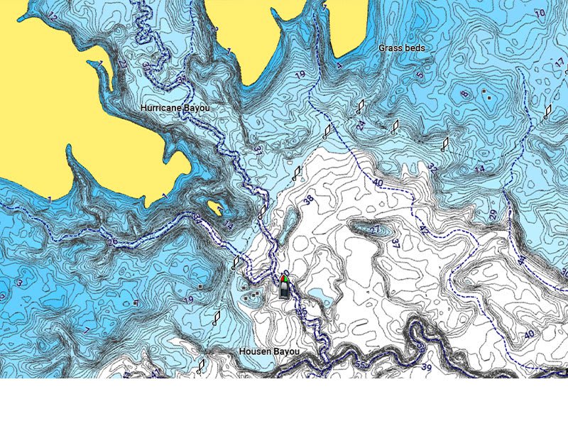
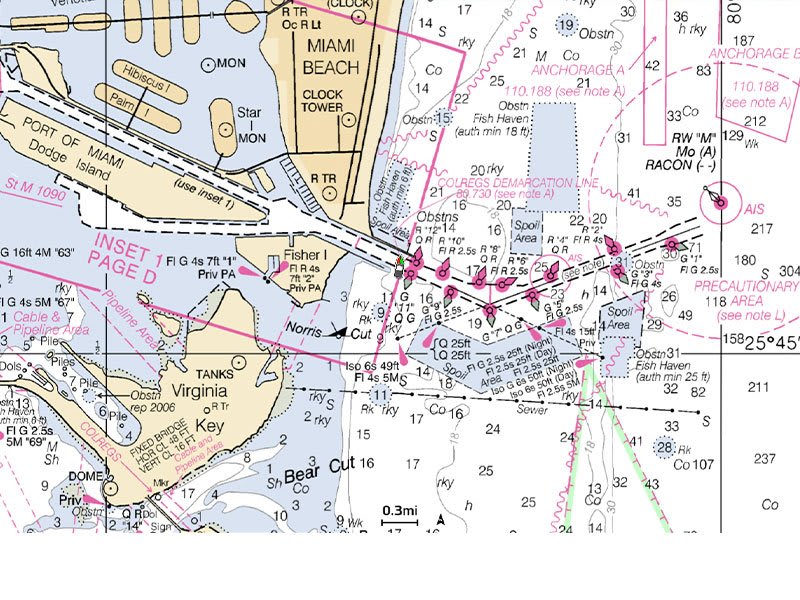
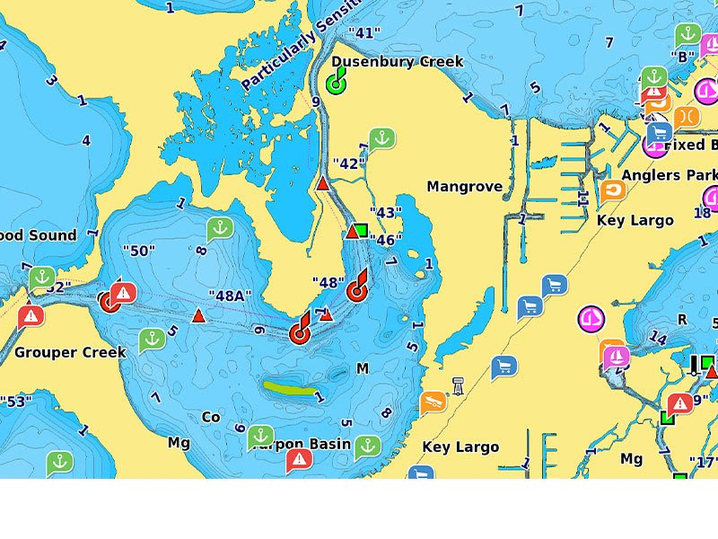
Featuring vibrant colors, a streamlined interface and combined coastal/inland content with a popular Navionics®style color palette, Garmin Navionics+ cartography makes it easy to plot your course with the world’s No. 1 name in marine mapping1.
Navigate with our best offshore and inland lake coverage for your Garmin chartplotter.
See it your way. Customize your view with various chart layers and overlay combinations.
With your included one-year subscription, access daily updates via the ActiveCaptain®smart-device app.
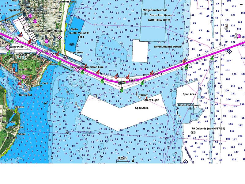
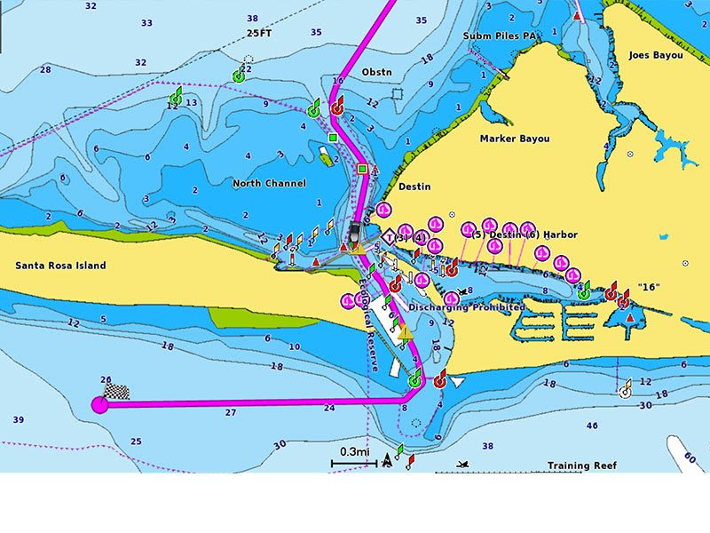
Auto Guidance+™technology2lets you navigate with suggested dock-to-dock routings.
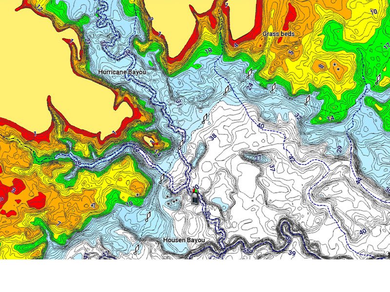
Select up to 10 color-shaded target depth ranges to scope out the best fishing spots.
Save money by renewing your subscription — and continue accessing daily updates plus new content downloads.
----------------------------
ALL-IN-ONE MAP SOLUTION FOR GARMIN CHARTPLOTTERS
Access detail-rich mapping of coastal features, lakes, rivers and more. Integrated Garmin and Navionics®content offers coverage for boaters worldwide.
DAILY CHART UPDATES
Charts are constantly being enhanced with new and amended content — as many as 5,000 updates are made every day. Your one-year subscription includes access to daily chart updates via theActiveCaptain app.
AUTO GUIDANCE+ TECHNOLOGY
Combining the best of Garmin and Navionics automatic routing features, built-in Auto Guidance+ technology2gives you a suggested dock-to-dock path to follow through channels, inlets, marina entrances and more.
DEPTH RANGE SHADING
High-resolution depth range shading lets you select up to 10 color-shaded options and view your designated target depths at a glance.
UP TO 1’ CONTOURS
For improved fishing and navigation, up to 1' contours provide a clear depiction of bottom structure for improved fishing charts and enhanced detail in swamps, canals, harbors, marinas and more.
SHALLOW WATER SHADING
To give a clear picture of shallow waters to avoid, this feature allows for shading at a user-defined depth.
RASTER CARTOGRAPHY
NOAA raster cartography3is available for some U.S. waters as a free downloadable feature via the ActiveCaptain app to provide paper chart-like views on your plotter.
ACTIVECAPTAIN COMMUNITY
Community-sourced contentprovides useful POIs, such as marinas, anchorages, hazards, businesses and more. Get recommendations from boaters with firsthand experience of the local environment.
Not the first thing that I've purchased through American Nautical Services. If there is a problem they reach out immediately, then follow through with what they say. This is a very very good company to rely on.

 Navigate with our best offshore and inland lake coverage for your Garmin chartplotter.
 See it your way. Customize your view with various chart layers and overlay combinations.
 With your included one-year subscription, access daily updates via the ActiveCaptain®
 Auto Guidance+™
 Select up to 10 color-shaded target depth ranges to scope out the best fishing spots.
 Save money by renewing your subscription — and continue accessing daily updates plus new content downloads.