Colección: A - The World - General Charts of the Oceans
A - The World - General Charts of the Oceans are print-on-demand (POD) and are fully up-to-date with the latest NTM corrections available. The Admiralty's standard nautical paper charts comply with Safety of Life at Sea (SOLAS) regulations and are ideal for professional, commercial, and recreational use.
(These charts are also known as UKHO - United Kingdom Hydrographic Office Paper Charts and British Admiralty (BA) Paper Charts)
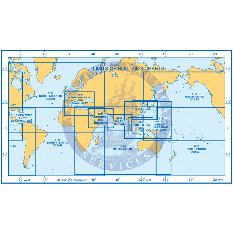
British Admiralty Chart Finder