
Electronic Navigation represents the most striking change in the modern history of sailing. As recent as the turn of the century, navigation primarily relied on paper charts. Planning, executing and monitoring a voyage consumed most of the time and attention of a crew. However, the introduction of modern digital navigational tools automated much of the work and changed the nature of transoceanic travel. As a result, the Electronic Navigational Charts (ENCs) that an Electronic Chart and Display System (ECDIS) relies on have largely replaced paper charts.
Over time, professional navigational officers have grown accustomed to these tools. However, it's comparatively recent that the law mandated hobbyists and small sailors to use ECDIS and ENCs. Not to mention, new sailors will also need to learn what an ENC is.
Basics of Electronic Navigational Charts
Electronic navigational charts are one of the two key elements of electronic navigation. An ECDIS functions as the hardware, while an ENC contains the dataset of relevant information for a voyage. Together, these two components create a powerful digital navigation solution. However, they bring much more to the table than eliminating paper waste and storage via basic digitization. Using electronic navigational charts together with ECDIS provides a crew with an array of advantages in planning, monitoring, and executing voyages.
Any modern navigational officer is well aware of the power of the ECDIS. It displays hazard warnings and alarms, enables simplified course modification and automatically identifies safe routes. You'll achieve these things by inputting accurate values into the ECDIS, such as the draft depth of the ship. Then, it automatically combines this input with oceanic data to create an accurate picture of areas where your ship can sail safely.
This is where the ENC comes into play. While you can fill your ECDIS with precise values on your ship, this is useless without accurate oceanic data. Electronic navigational charts provide your ECDIS with the external, journey-specific data to function properly.
What is an Electronic Navigational Chart (ENC)?

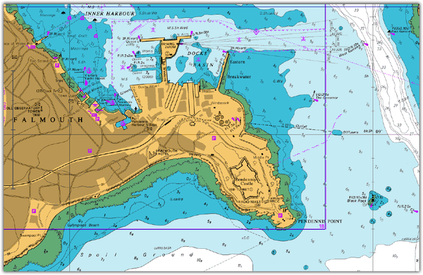
Electronic Navigational Charts (ENC), also known as vector charts, are data sets to support all types of nautical navigation. Originally, large commercial vessels adopted them for the sake of SOLAS compliance, efficiency, and safety benefits. In the modern nautical landscape, smaller ships and recreational sailors also make use of ENCs in electronic chart system (ECS) programs. Electronic navigational charts are the main type of charts that an ECDIS relies on, although there are others, such as Raster Charts.
In their complementary role to ECDIS hardware, an ENC provides a diverse array of information and automation features. These include, but are not limited to:
- Possible dangers
- Routes
- Maritime limits
- Aids to navigation
- Depths
- Nature of the seabed
- Elevations
- Configuration and characteristics of the coast
Vector charts enable sailors to create customized displays, depth alerts and more via a the ECDIS. The user can gain a broader visualization by collapsing elements, or access more detailed information about an area by selecting it. These quality of life features make navigation a much simpler, less strenuous process. As a result, electronic navigational charts are entirely indispensable to the modern sailor.
Electronic Navigational Chart Requirements and Standards
Official ENCs must follow several international legal standards. The 1974 IMO SOLAS Convention lays down the basic regulatory framework for using ENCs and ECDIS. Since then, numerous International Maritime Organization (IMO) Resolutions have created a more thorough set of performance standards. As the capabilities and importance of electronic navigation grew over the years, the International Hydrographic Organization (IHO) also developed further detailed standards on ENCs in several publications.
The IMO SOLAS Convention
In 2002, the International Maritime Organization (IMO) made a major amendment to Chapter V of the International Convention for the Safety of Life At Sea (SOLAS). Under the revised Chapter V, the most relevant regulations are Regulation 2, Regulation 19 and Regulation 27.
Regulation 2 provides a legal definition of vector charts. On the other hand, Regulation 19 describes carriage requirements for shipborne navigational systems and equipment. In doing so, it specifies that ECDIS will allow shipowners to meet the chart carriage requirement. This meant that a ship that uses ECDIS could use it to the exclusion of traditional paper charts. Additionally, it imposes an obligation for all vessels regardless of the size and type to carry up-to-date nautical charts and publications for the intended voyage.
Regulation 19 also requires that ships must rely on ENCs to prepare, plot and check the intended route for the voyage. Finally, all vessels that make (even partial) use of ENCs must carry alternative backup arrangements. These can be digitized Raster Charts, a second ECDIS system or paper charts. Regulation 27 imposes a requirement for crews to keep charts and publications up to date.
However, these requirements did not come into effect overnight. Practical implementation took place in a phased manner over one and a half decades. Today, however, all shipowners must install ECDIS before August 2017. The consequences for non-compliance are severe; a flag state inspection could result in financial penalties or detainment.
IMO Resolutions
The IMO has put forward performance standards for ECDIS and vector charts in many Resolutions. Particularly, IMO Resolution A.817 (19) as amended by Resolution MSC.64 (67) regulates backup arrangements. These resolutions require contingencies to remain in place, Should there be a technical failure that prevents the crew from using their ENCs.
IHO Publications
The International Hydrogeographic Organization (IHO) lays down further specific standards. The most comprehensive regulation consists of the IHO Publication S-66, but there are other important publications as well.
IHO Publication S-63 sets the regulatory framework to encrypt and digitally sign ENC data, while IHO Publication S-57 lays out the standards to capture chart data. IHO Publication S-52 explains how to display them so to ensure a consistent rendering between different systems. Finally, IMO Resolution MSC.232(82) lay down performance standards for ECDIS.
In short, these are the essential ENCs standards:
- ENC content must rely on the latest source data available to the relevant Hydrographic Office.
- ENC compilation and codification must comply with the international standards set by the IHO.
- The World Geodetic System 1984 Datum (WGS 84) must be the reference for ENCs positions. This is directly compatible with GNSS positions.
- Only the authority of a government, an authorized Hydrographic Office or other relevant government institution can issue ENCs.
- Sailors must update ENCs with official update information, subject to digital distribution.
Types of ENCs
ENCs adhere to certain requirements and standards, and always work with an accompanying ECDIS. However, there are many different types of ECDIS systems. Some are suited to oceanic travel, while others serve inland waters or other niche purposes.
IENCs
Inland Electronic Navigational Charts (IENCs) are specific ENCs for navigable inland waters (rivers, canals, lakes, and others). These ENCs contain particular extensions that serve their unique role to brown-water transit. Their features serve specific river-navigation needs, not relevant for maritime ENCs such as notice marks.
They rely on a specialized Inland Electronic Chart Display and Information System (Inland ECDIS). Similar to other ENCs, their regulatory framework is IHO Publication S-57. The Inland ENC Harmonization Group (IEHG) supports the development of further international standards for this type of ENCs.
PENCs
Port Electronic Navigational Charts (PENCs) is the most suitable tool for maneuvers that need large-scale charts (1:2000 or better). These charts provide the most accurate topographic data.
PENCs concept dates back to 2009. The product specification emerged within the framework of the Efforts Project WP 1.3 PortECDIS, led by the Hamburg Port Authority.
bENCs
Bathymetric Electronic Navigational Charts (bENCs) are a complement that vessels can use in combination with an ENC or IENC. As opposed to PENCs, they do not contain all the information that by ENCs or IENCs provide. bENCs owe their existence to SevenCs, who first developed the concept 15 years ago. The company derived the product specification from the IHO ENC Product Specification.
IHO Publication S-57 lays down the relevant standards for bENCs, as a mere extension for regular ENCs. The IEHG envisaged the bENC Inland counter-part in the IECDIS Standard 2.4.
These charts provide highly dense bathymetric data. Among these, depth contours, selected soundings, depth areas, and quality-related information. The information derives from hydrographic-survey datasets. This allows for a certain degree of automatization in the production, which improves affordability and availability. The most popular use for bENCs is within portable pilot systems, where their depth of information becomes highly useful.
Raster Charts
You may not be able to get ENCs covering the whole voyage. In such cases, you can resort to Raster Charts. These are much more simple digital tools. They consist of scanned version paper charts you can store electronically. Official ENCs integrate a broad range of ECDIS features and are, resultantly, much more than digitized charts.
Conversely, Raster Charts don't have any extra functionality. You can't expand or remove certain information elements, and there's no built-in alarms or depth features. Using a Raster Chart more or less resembles loading and observing an image on an electronic device. In these charts, you can constantly visualize all text and chart data. Zooming in or out will equally affect every part of the chart. Similarly, if you rotate the chart you will rotate the text together with the image.
How are ENCs Distributed to Vessels?
The use of official ENCs is mandatory. Thus, an efficient and reliable ENC data distribution service is essential. For this purpose, the IHO created the Worldwide ENC Database (WEND). The WEND arrangements also provide for the creation of Regional Electronic Navigational Chart Coordinating Centres (RENCs). ENC-producer countries are part of this non-profit organization. The most popular RENC is the United Kingdom Hydrographic Office (UKHO) which distributes ENCs through their solution called the ADMIRALTY Vector Chart Service (AVCS).

The role of RENCS is to act as global wholesalers of electronic navigational charts. They also independently check that ENCs follow relevant IMO and IHO standards. RENCs can also issue certifications to qualify other distributors as ENC service providers. These, in turn, can act as distributors under a license agreement.
Finally, some national Hydrographic Offices distribute ENCs directly to end-users. If this is the case, users must download ENCs and from the Hydrographic Office's official website.
How Do You Keep ENCs Up to Date?
Chapter V of the SOLAS Convention requires to maintain ENCs up-to-date. Hence, hydrographic offices regularly issue Notice to Mariners and other chart updates. Stage 9 in IHO Publication S-65 specifies the standards for distribution.
Generally, the ECDIS is able to apply regular update information to the chart data via a digital data file. This happens by means of wireless transmission, or on suitable media such as a CD-ROM. Alternatively, an ECDIS function enables crew members to update the vector charts manually. This option is essential, as it can happen that a digital update is not available. A hydrographic office may issue update information in forms other than digital.

Originally, most ENC updates utilized CD-ROM storage which a captain could buy. Nowadays, remote updating via satellite (or, when in port, shore-based) telecommunications is an increasingly popular update option. An increasing number of providers now distribute updates via e-mail, the web and other remote means.
At American Nautical, we offer our SPICA e-Navigation software as a solution to order, download, and export ENCs to the ECDIS to keep the ENC charts up to date in the ECDIS. See our blog to learn more about how to do this process.
How Can I Be Sure to Fully Update My ENCs?
An ECDIS keeps an internal list of every update and the date of their application. Vector chart updates are sequential, and each sequence is unique to each ENC. Thus, ECDIS is able to control whether the user has applied all the updates in the sequence. Should an update be missing, the ECDIS creates a notification. Not to mention, it is not possible to apply later updates as long as all the earlier ones are missing.
Another useful function of ECDIS is the ENC Update Status Report. By exploiting it, the user can generate a report indicating the revision status of the ENCs. Annex C of IHO Publication s-63 specifies the format and content of the Report. Some ENCs providers offer further tools to generate reports on the relevancy of your current vector charts.
In case ECDIS is not able to perform the report function automatically, the task is up to the end-user. They must manually create and maintain a list of updates, at which point they'll be able to rectify any lack of up-to-date charts. To do so, they should rely on vector chart distributors. Regulations require distributors to have the ability to provide sailors with details of the latest ENC editions and update numbers as needed. Vessels who use our SPICA e-Navigation software are able to view the status of its ENC charts and be able to see if the ENC charts are up tp date according to the report in SPICA.
In practical terms, Port State Control Officers generally refer to the update status report function of ECDIS. The report easily allows them to check that sailors have kept ENCs up to date under SOLAS V Regulation 27.
Keep Up to Date on Vector Charts
While the law requires you to use ECDIS if your vessel is over 500GT, the advantages of electronic navigation are too great to ignore. By equipping your vessels with good electronic navigational charts, you'll reap the benefits of efficient, automated navigation tools. When you want to leverage technology to achieve a high degree of safety and precision in your navigation, you should consider using an ECDIS along side our SPICA e-Navigation software for passage planning.

Sign Up For a Free Trial
Here at American Nautical, sailing and navigation are our passion. When we take to the ocean, we trust our SPICA e-Navigation Software. It's a powerful, yet user-friendly program that comes with all the important features that make ECDIS so useful. When you plan a voyage, it can automatically generate a complete list of all ENCs necessary for your trip.
And if you're looking to keep up with the latest developments in navigation technology, you should follow us. We pride ourselves on the part we play in keeping people informed and up-to-date on maritime affairs.

Join Our Newsletter!


