


Admiralty Raster Chart Service (ARCS) makes nautical charts offered by the United Kingdom Hydrographic Office (UKHO) portfolio available in a convenient electronic format. Wide-ranging, official coverage of global commercial shipping routes, major ports and harbors with many scales and a selection of over 3,000 charts is available. To provide maximum flexibility, ARCS charts are available to be licensed on a chart by chart basis. Mariners need only pay for charts required.
ARCS charts use the same familiar image and the internationally recognized symbols used on Admiralty nautical charts; making them an intelligent first choice for the conversion from chart table to digital navigation.
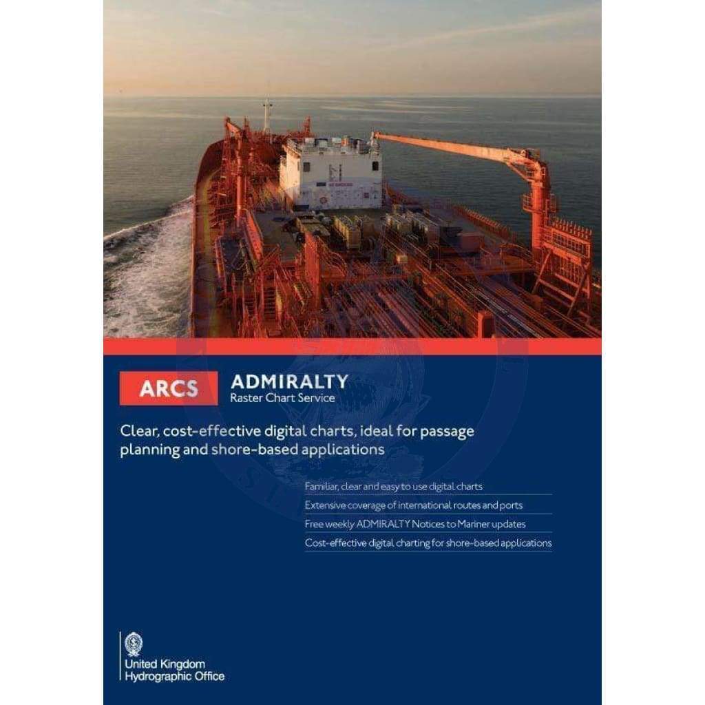
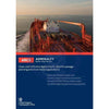
Admiralty Raster Chart Service (ARCS)
Cost-effective and clearly-plotted digital charts, perfectly suited for planning passages and shore-based applications
ARCS offers:
- Easy-to-use digital charts in a clear and familiar format.
- International routes and ports are extensively covered.
- Admiralty Notices to Mariner updates are provided on a weekly basis, free of charge.
- Perfect for shore-based applications in need of cost-effective digital charting.
Over 3,000 of the world's leading Admiralty paper charts are stored in digital format using ARCS.
Why ARCS?
The familiar appearance of traditional and well-known Admiralty paper charts is kept, while adding precision tracking capabilities of satellite positioning with ARCS, which enables bridge crews and shore-based users to make well-informed, timely decisions. Decisions that may keep crews and cargo safe while saving time and capital.
ARCS offers the most complete, official digital chart coverage available today, when used together with Admiralty Vector Chart Service (AVCS) ENCs.
Unlike traditional paper charts, which need to be updated manually by hand, ARCS is updated almost instantly, using the Admiralty free update service. Keeping charts, which are depended on for safe navigation, regularly updated is an essential component of safe and efficient navigation.
ARCS is the perfect choice for cost-effective land-based applications such as planning voyages, monitoring passages and incident management, which is often performed in shipping company offices.
ARCS is compatible with a wide range of electronic chart display and information systems (ECDISs) and electronic chart systems (ECSs.) ARCS may be viewed using the UKHO’s Planning Station PC application available, free of charge, for Admiralty customers.
Familiar, clear and easy to use
The chart legend, including symbols and imagery used with ARCS is the same as that used with traditional Admiralty standard nautical charts used by professional mariners for generations.
When combined with accurate satellite positioning in an ECS or ECDIS navigation system, this familiarity improves awareness in key situations and aids crews in understanding critical information at times of maximum stress and workload. This aspect of ARCS brings calm and confidence to bridges.
When used jointly with AVCS ENCs, ARCS enables bridge crews to effectively plan routes ahead and complete voyages in a safe and efficient manner, every time.
Efficient shore-side monitoring of your fleet
Most large commercial fleets have significant land-based operations supporting their businesses that may include disaster-management rooms. ARCS gives commercial maritime shippers a cost-effective, complete digital charting solution and is compatible with many office-based chart display systems. ARCS can even be displayed on mobile devices. The progress of fleets may be monitored by fleet managers, even for ships that are using paper charts.
A range of flexible and cost effective purchase options are available.
ARCS is available in one world folio or 10 regional folios providing cost savings: pay only for charts needed to successfully plan and complete a journey.
Alternatively, raster charts within ARCS may be purchased individually, on a chart-by-chart basis allowing for precise coverage and flexibility in a cost-effective manner.
There’s no need for physical chart delivery – purchase licenses remotely to gain access to charts that are needed.
Global coverage
ARCS provides extensive raster chart coverage of shipping routes globally, including main ports and harbors in a full range of scales, with over 3,000 official charts.
The most comprehensive and trusted digital chart service available for ships trading internationally is created when the extensive coverage, familiarity and ease-of-use of ARCS is combined with AVCS.
Official Raster Navigational Charts
Under certain conditions, where ENCs are not available or don't exist yet, raster navigational charts (RNCs) are a reliable and safe alternative for primary navigation, subject to individual port and flag state approval (IMO resolution MSC 86(70.))
Digital raster copies of official Admiralty paper charts, conforming to IHO Product specification S-61 are contained within the ARCS raster service.
Efficient weekly updates, including T&P NMs
To ensure that bridge crews have access to current, up-to-date information and data, weekly updates are provided to all ARCS customers. They are available via e-mail, download or shipped CD. The most current Admiralty Notices to Mariners (NMs) are applied quickly, accurately and conveniently using the regular updates.
Also included with weekly updates are all Temporary and Preliminary Notices to Mariners (T&P NMs) issued by quality assurance processes implemented by the UKHO.
Synchronized weekly chart updates for simplicity
Weekly updates for ARCS are synchronized with the most current Admiralty paper chart weekly Notices to Mariners, including matching reference numbers. This allows crews less complexity, reducing confusion when using paper charts and ARCS side-by-side.
Easy chart selection, ordering and management
There are a variety of ENC tools that support ARCS including the Admiralty e-Navigator Planning Station, which is a chart ordering and management system. The station allows bridge crews to know when new information has become available, what is on board and how current it is. The e-Navigator Planning Station provides timely updates and new information via the Internet. The planning station is available to Admiralty nautical products and services customers at no cost.
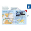
Large-scale charts in ARCS
ARCS can help identify important information using large scales, such as dredged depths and berth names, which may be difficult to find in the ENC.
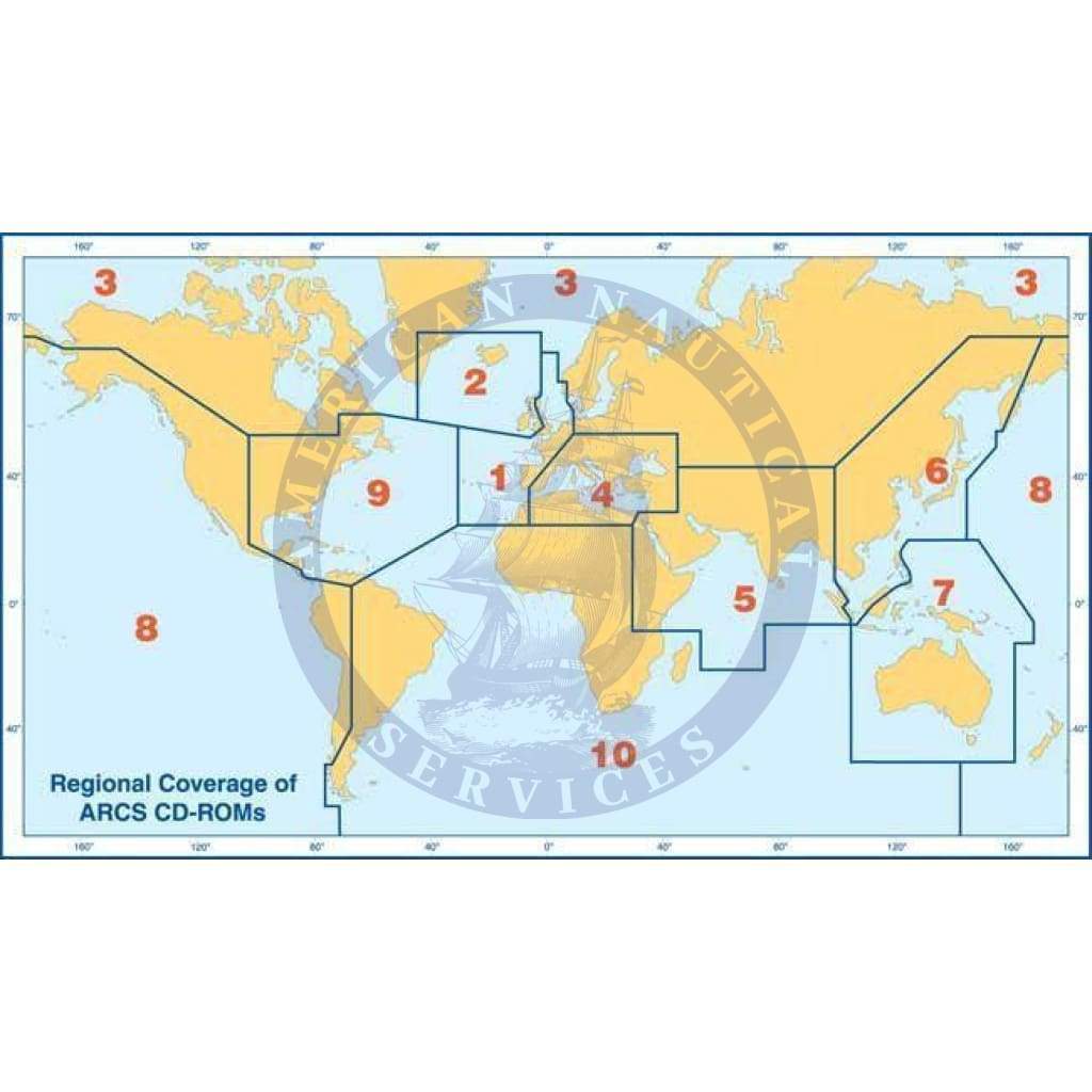
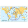
ARCS global coverage by region
Complete global coverage is available on 11 CD-ROMS: Disks 1 through 10 contain the individual regions, and disk 11 contains ocean charts (scale 1:3,500,000 and smaller.)
For more information about ARCS, including recommendations for specific situations, pricing details and quotes for coverage, please contact us.


