Double click image to zoom in

Usually ready in 24 hours
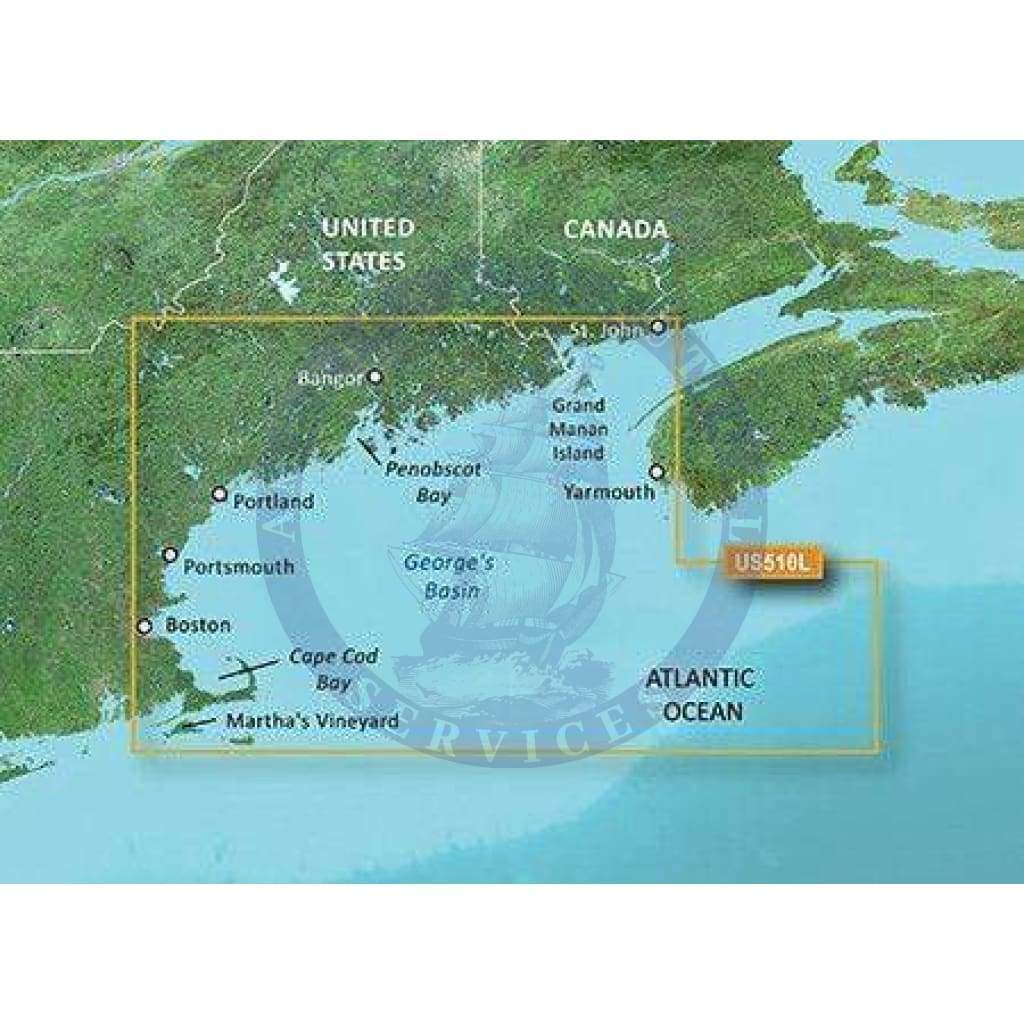
Detailed coverage the east coast of the U.S. and Canada from Cape Cod to St. John, NB, including Boston, MA, Portsmouth, NH, and Portland, ME, as well as the Kennebec R. to Augusta, ME and the Penobscot R. to Bangor, ME. Coverage also includes Martha's Vineyard, Nantucket Island, Grand Manan Island, Mt. Desert Island, and Calais, ME as well as St. Mary's Bay and Yarmouth, NS. Bathymetric coverage includes George's Basin, Franklin Basin, and the Northeast Channel.
See your vessel’s precise, on-chart position in relation to navaids, coastal features and restricted areas with premium features found in this detailed marine mapping data. Includes all of the features of our BlueChart® g2 HD product, plus 3-D perspective above and below the waterline, Auto Guidance, high-resolution imagery, and aerial photos of ports, harbors, marinas and landmarks.

+1 954-522-3321
sales@amnautical.com
American Nautical Services, Inc.
3311 S Andrews Ave, Suite 11
Fort Lauderdale, FL 33316
United States of America


