Description
This chart has been canceled by NOAA as of 5/1/2024 and is no longer maintained with updated data.
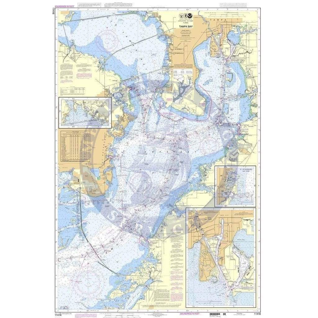
NOAA Nautical Chart 11416: Tampa Bay; Safety Harbor; St. Petersburg; Tampa is a standard navigation chart used by commercial and recreational mariners alike. Printed "on-demand" with water resistant paper. This chart meets the definition of a nautical chart laid out in SOLAS Chapter V Regulation 2.2 and also meets the carriage requirements defined in SOLAS Chapter V Regulation 19.2.1.4
In 2019, NOAA announced its Sunsetting of Raster Nautical Charts. The raster sunset program will gradually end production and maintenance of NOAA traditional paper nautical chart products. Beginning in 2021, NOAA will start canceling its traditional nautical charts. The process is expected to be completed by January 2025.
NOAA Custom Chart App is an online application that enables users to create their own customized nautical charts directly from the latest official NOAA electronic navigational chart (NOAA ENC®) data.
Oceangrafix an official NOAA Chart printer that can also print NOAA Custom Charts (NCCs) created with the NOAA Custom Chart Application.
Additional Information
NOAA Custom Chart (Updated)
Scale: 40000
Paper Size: 36.0" x 54.0"
Actual Chart Size: 33.3" x 52.3"
Traditional NOAA Chart (Sunsetted)
Scale: 40,000
Paper Size: 36.0" x 54.0"
Actual Chart Size: 33.7" x 50.7"
Edition #: 17
Edition Date: 2022-07-07