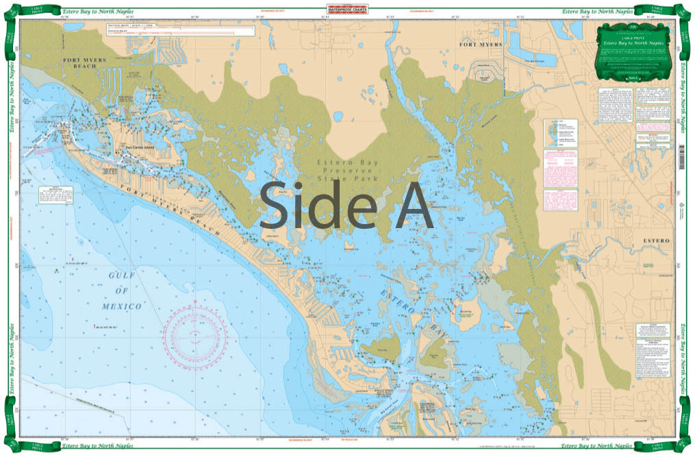
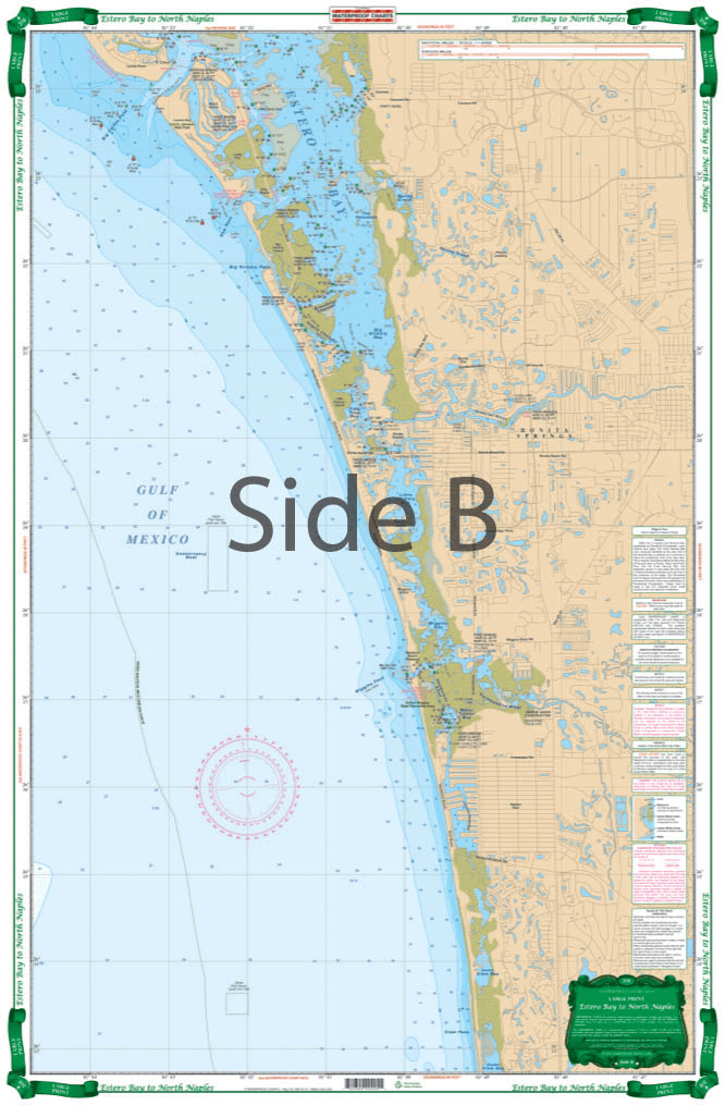

The Estero Bay to North Naples Nautical Chart has detailed coverage of this shallow area with local names and channels. The north side covers Fort Myers Beach, Matanzas Pass, Hurricane Bay, Estero Island and north Estero Bay to Mound Key, including the Hendry Creek, Mullock Creek, the Estero River, Big Carlos Pass, and the Lovers Key State Park area. The south side covers southern Estero Bay, Spring Creek, Fish Trap Bay, New Pass south thru Bonita Beach and the Vanderbilt Channel and Outer Clam Bay. Continues south thru inside route behind Wiggins Pass with complete marker detail and south to the Vanderbilt Beach waterways and canals. Extensive field work details channels and markers available from no other source. Information from county sources, NOAA charts, USGS topographical maps and local experts. Beautiful colors make it suitable for framing. WGS84-World Mercator Datum.


Overall, everything went exceptionally smooth. Very easy to find the books I was looking for, very easy to check out, shipping actually arrived a day early
I bought two lots of Timezero software from this business and was very happy with the service. Very professional and great communication to back up the purchase. I will be using them again next time I need some more software.
New Orleans and Lake Pontchartrain Waterproof Chart, 2nd Edition
The chart needs the bottom contour lines showing the 16, 21 & 28 fathom contour lines.