
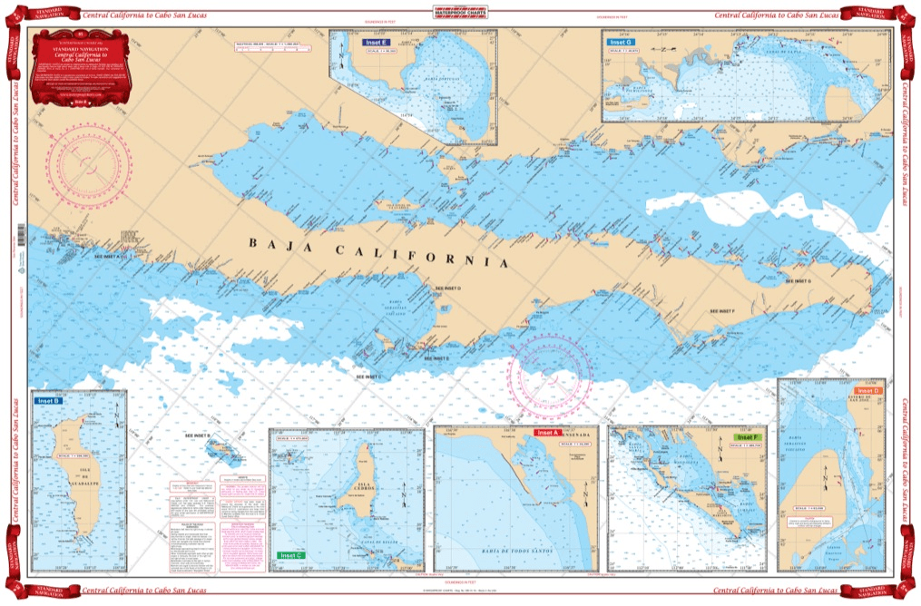
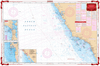
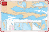
Coverage from Navarro Head California south to Ensenada including Punta Santo Tomas, Punta San Jose, Punta Piedras, and Punta Colnett. GPS waypoint table for the major entrances are listed as well as 10 insets that show the entrances in large scale. Information from 3 NOAA Charts,#18020, #18765, #18640 & NGA #21008. Chart #83 continues north to the Dixon Entrance & Alaska. No trip between Central California and Cabo San Lucas is complete without this marine map. You will be able to easily plot a trip through this region using this highly detailed nautical map. This chart is also excellent for framing and giving as a gift or displaying in a home or office. Coverage from Navarro Head California south to Ensenada including Punta Santo Tomas, Punta San Jose, Punta Piedras, and Punta Colnett. A GPS waypoint table has major entrances listed, as well as 10 insets that show the entrances in large scale. Information from 3 NOAA Charts #18020, #18765, #18640 & NGA #21008. Nautical Chart #83 continues north to the Dixon Entrance and Alaska. Navigation Chart is 25″ X 38″. WGS84 – World Mercator Datum.


Overall, everything went exceptionally smooth. Very easy to find the books I was looking for, very easy to check out, shipping actually arrived a day early
I bought two lots of Timezero software from this business and was very happy with the service. Very professional and great communication to back up the purchase. I will be using them again next time I need some more software.
New Orleans and Lake Pontchartrain Waterproof Chart, 2nd Edition
The chart needs the bottom contour lines showing the 16, 21 & 28 fathom contour lines.