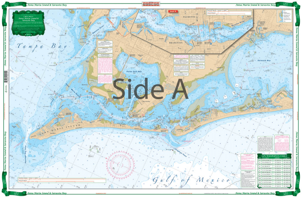
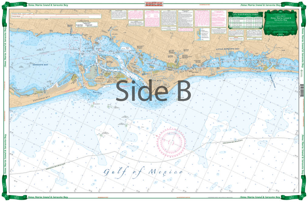

Very large blown up coverage from Anna Maria Island south to Little Sarasota Bays and up the Manatee River to Bradenton and Palmetto. Detail for Sarasota. Large Place names make areas easy to find. A total of 19 plotted and indexed GPS Waypoints make it easy to set up your electronics. Don’t go anywhere without this Anna Maria Sound and Sarasota Bays navigation chart! We use data compiled from 2 NOAA charts to give you a more comprehensive overview of this boating area. This nautical map has a very large blown up coverage from Anna Maria Island south to Little Sarasota Bays and up the Manatee River to Bradenton and Palmetto. Detail are also included for Sarasota. Large place names make areas easy to find, even when boating at high speeds! (Though we don’t recommend you read and drive). A total of 19 plotted and indexed GPS Waypoints make it easy to set up your electronics. Get a second copy of this navigation map. Why? Because you’ll love the vibrant colors so much you’ll get it framed and hung on your wall. Information from 2 NOAA Charts: #11425 and #11411. Nautical chart is 25″ X 38″. WGS84 – World Mercator Datum.


Excellent Services
I wanted a quality chart delivered promptly at an acceptable price.
Mission accomplished...
Order placement and pickup was efficient and easy! I made an order mistake and they fixed it quickly for me. Hal was such a pleasure to talk to as well. Product is as described. Thanks!
My wife and I are still a few years away from casting off the dock lines on this journey, but Skipper Bob's insights have really framed my thinking about the Big Picture. I burned through the book in just a few days and have already changed some of our early planning based on the information I gleaned.
Thanks to all of you for keeping this valuable resource readily available!