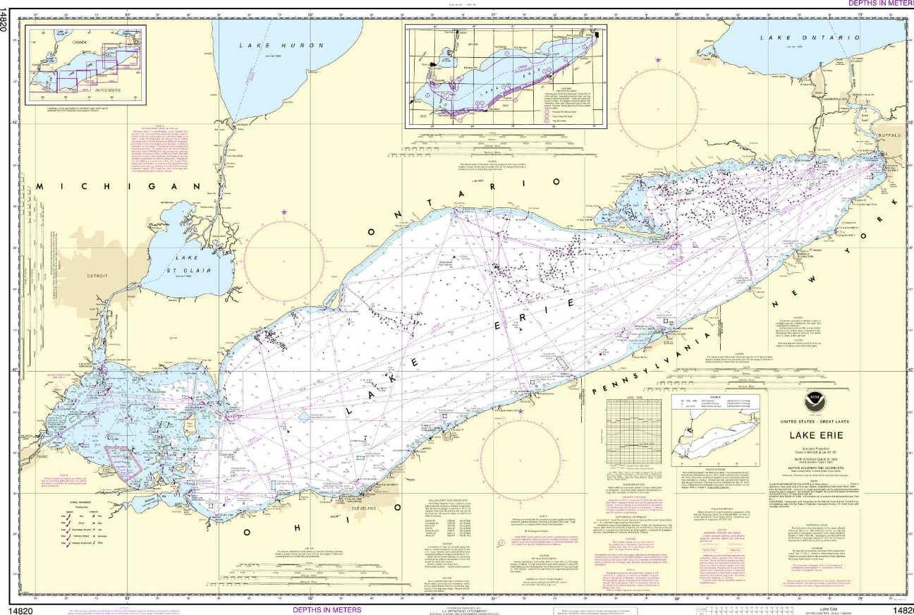
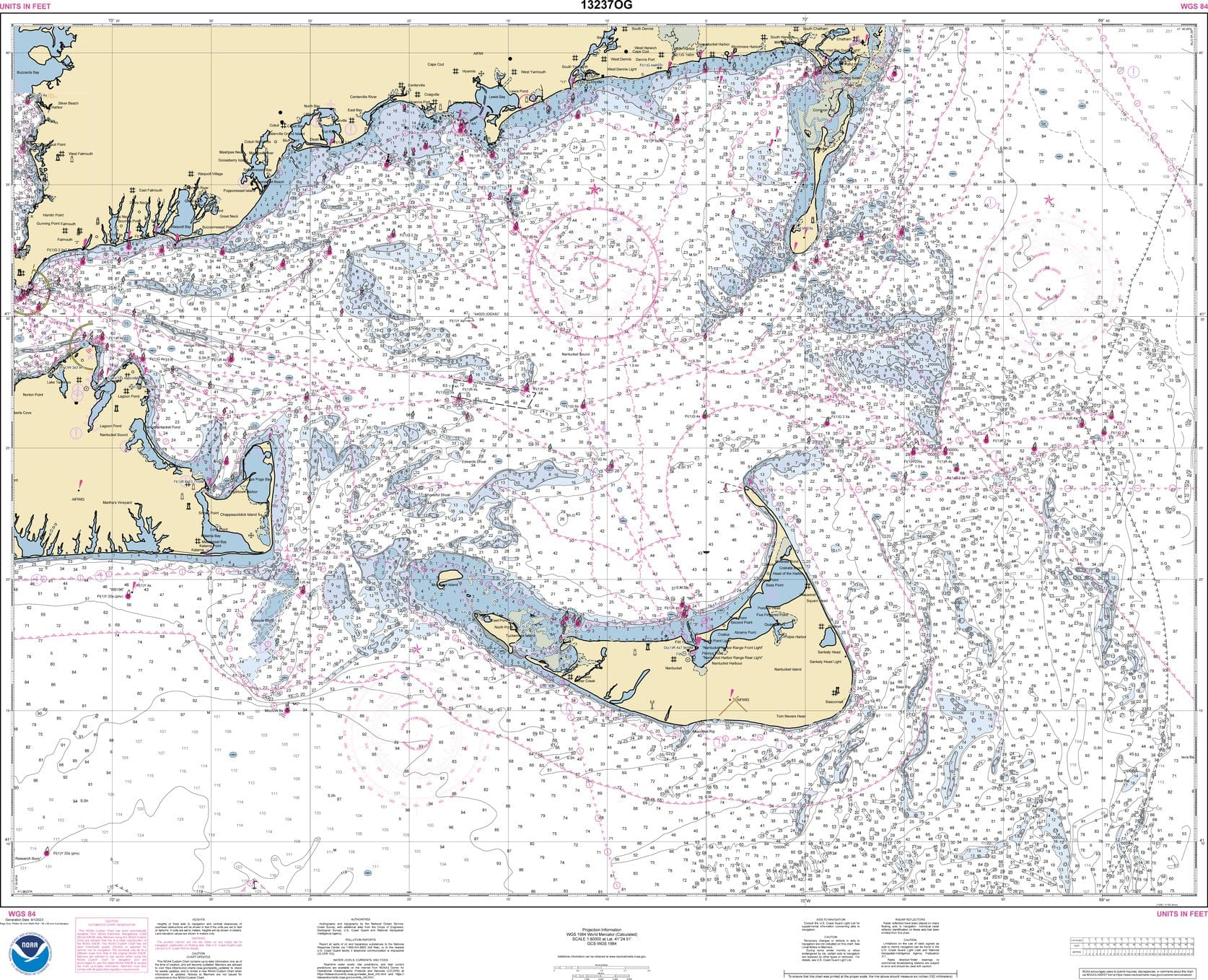
National Oceanic and Atmospheric Administration (NOAA) nautical charts are produced and distributed to American Nautical Services in an electronic format. When mariners place orders for nautical charts they are printed using the latest "Print on Demand" technology offered in partnership with OceanGrafix. This ensures that only the most up-to-date notice to mariner information is provided on the charts.
Additionally, NOAA nautical charts are printed on water resistant paper, which is designed to withstand the heavy wear and wet conditions encountered in nautical environments.
NOAA nautical charts meet the carriage requirements defined in the Safety of Life at Sea (SOLAS) convention Chapter V Regulation 19.2.1.4 as well as Title 33 of the Code of Federal Regulations, Part 164, Navigation and Navigable Waters, Navigation Safety Regulations and Title 46 of the Code of Federal Regulations, Shipping.
NOAA was formed in 1970 and was an amalgamation of several ancestor agencies, including: the United States Coast Survey, formed in 1807; the United States Weather Bureau, formed in 1870; and the United States Commission of Fish and Fisheries, formed in 1871. NOAA is an agency of the U.S. Department of Commerce and is responsible for the conditions of the oceans and the atmosphere and issuing warnings of dangerous weather, charting waterways and skies and guiding the use and the protection of coastal and ocean resources.
The SOLAS convention has roots that can be traced to 1914 and the sinking of the HMS Titanic. Its modern form was first proposed in 1960 and put into force in 1965. It was the first major milestone achieved by the International Maritime Organization. Subsequent SOLAS versions were implemented in 1974 and 1988. The SOLAS convention sets out rules and regulations for safety standard in construction, equipment and operation for 159 member flag states, many of which have incorporated its provisions into local law.
The Code of Federal Regulations contains 50 volumes setting out rules and regulations pertaining to agencies and departments of the U.S. federal government, ranging in topic from Energy and Federal Elections to Navigation and Navigable Waters and Shipping.
NOAA nautical charts are designed and updated to comply with both SOLAS Convention and Code of Federal Regulations requirements.