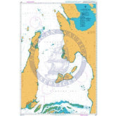
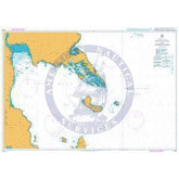
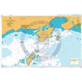
Colección: Nautical Charts

Nautical Charts

Nautical charts are available in two general formats: physical charts, which are printed on paper and electronic charts, which are displayed on an electronic chart display and information system (ECDIS). Each type of nautical chart may be purchased online or ordered over the telephone.

British Admiralty nautical charts are produced by the United Kingdom Hydrographic Office (UKHO) and have been updated to conform to the most recent notices to mariners. They conform to nautical chart carriage requirements detailed in in Safety of Life at Sea (SOLAS) Chapter V Regulation 2.2 and also meet the carriage requirements in SOLAS Chapter V Regulation 19.2.1.4.

Nautical charts and other information services provided by the UKHO are widely-regarded as standard-setting in the industry. British Admiralty nautical charts are designed to provide mariners with the most up-to-date nautical information and keep fleets in compliance with prevailing legislation; legislation that is intended to keep crews safe.

The U.S. National Oceanic and Atmospheric Administration (NOAA) also produces high-quality nautical charts that comply with SOLAS Chapter V Regulation 2.2 carriage requirements and also meet the carriage requirements in SOLAS Chapter V Regulation 19.2.1.4. NOAA nautical charts are printed "on-demand" so that they are updated to include the most recent information available.

NOAA nautical charts have an equally impressive provenance and are highly regarded for their accuracy, ease-of-use and durability. NOAA charts are printed on water resistant paper, which is specifically designed to stand up to wet and damp maritime environments.

All nautical charts available are updated to include information provided by NOAA and UKHO as reported in notices to mariners. It is important that mariners with carriage compliance requirements stay aware of subsequent notices to mariners and update their chart libraries accordingly.

British Admiralty charts produced by the UKHO and NOAA nautical charts are available for a range of locales. Browse the entire selection of British Admiralty and NOAA nautical charts that are available. Mariners are bound to find the nautical chart they need to stay safe and compliant in the list of titles available online from British Admiralty and NOAA nautical charts. No matter where your voyage will take you, British Admiralty and NOAA have the charts you need to plan a successful passage and remain compliant with your flag state's nautical chart carriage requirements.

Filter By
3916 de 7875 productos
SPICA SPICA Borrar todo
British Admiralty Nautical Chart 4405: North Atlantic Ocean, Labrador Sea, Strait of Belle Isle to Davis Strait
Precio
$55.95
British Admiralty Nautical Chart 438: France – North Coast, Boulogne-Sur-Mer
Precio
$55.95
British Admiralty Nautical Chart 431: Brazil – Southern Coast, Porto de Sepetiba and Approaches
Precio
$55.95
British Admiralty Nautical Chart 4240: Bahia Valparaiso to Golfo de Arauco
Precio
$55.95
British Admiralty Nautical Chart 4212: Drake Passage
Precio
$55.95
British Admiralty Nautical Chart 4208: Ilha da Trindade to Tristan da Cunha Group
Precio
$55.95
British Admiralty Nautical Chart 4207: Falkland Islands to Cabo Corrientes and Northeast Georgia Rise
Precio
$55.95
British Admiralty Nautical Chart 4206: Tristan da Cunha Group to Discovery Seamounts and Islas Orcadas Rise
Precio
$55.95
British Admiralty Nautical Chart 4204: South Atlantic and Indian Oceans, Walvis Bay to Maputo
Precio
$55.95
British Admiralty Nautical Chart 4200: Rio de la Plata to Cabo de Hornos
Precio
$55.95
British Admiralty Nautical Chart 4157: Republic of South Africa, South Coast, Approaches to Port Elizabeth
Precio
$55.95
British Admiralty Nautical Chart 4154: Republic of South Africa, South Coast, Mossel Bay
Precio
$55.95
British Admiralty Nautical Chart 4127: China - Hong Kong, South Eastern Approaches
Precio
$55.95
British Admiralty Nautical Chart 4126: China - Hong Kong, Port Shelter
Precio
$55.95
British Admiralty Nautical Chart 4121: Lamma Channels
Precio
$55.95
British Admiralty Nautical Chart 4112: North Atlantic Ocean, Iceland to Greenland
Precio
$55.95
British Admiralty Nautical Chart 4102: North Atlantic Ocean, Western Approaches to the British Isles
Precio
$55.95
British Admiralty Nautical Chart 4075: Southern Ocean, Kapp Norvegia to Îles Kerguelen
Precio
$55.95
British Admiralty Nautical Chart 4074: Southern Ocean, Cape Darnley to Tasmania
Precio
$55.95
British Admiralty Nautical Chart 4064: Marie Byrd Land to Southwest Pacific Basin
Precio
$55.95
British Admiralty Nautical Chart 4038: Malaysia and Singapore, Johor Strait, Western Part
Precio
$55.95
British Admiralty Nautical Chart 4037: Port of Singapore, Keppel Harbour, Tanjong Pagar Terminal and Approaches
Precio
$55.95
British Admiralty Nautical Chart 4020: South Atlantic Ocean Western Part
Precio
$55.95
British Admiralty Nautical Chart 4014: North Atlantic Ocean Eastern Part
Precio
$55.95
British Admiralty Nautical Chart 4001: A planning chart for the Atlantic and Indian Oceans
Precio
$55.95
British Admiralty Nautical Chart 3: Indian Ocean, British Indian Ocean Territory, Chagos Archipelago
Precio
$55.95
British Admiralty Nautical Chart 3997: South Pacific Ocean, Solomon Islands, Indispensable Strait
Precio
$55.95
British Admiralty Nautical Chart 3996: Santa Isabel Island to Guadalcanal Island
Precio
$55.95
British Admiralty Nautical Chart 3994: Bougainville Island to Ghizo Island
Precio
$55.95
British Admiralty Nautical Chart 3990: South China Sea, Gulf of Tonkin - (Northern Part)
Precio
$55.95
British Admiralty Nautical Chart 3979: Ponta dos Tres Irmaos to Cabedelo
Precio
$55.95
British Admiralty Nautical Chart 3971: Cabo de Sao Tome to Rio de Janeiro
Precio
$55.95
British Admiralty Nautical Chart 3959: Approaches to Rio Para and Rio Amazonas
Precio
$55.95
British Admiralty Nautical Chart 3951: Qatar, Saudi Arabia and United Arab Emirates, Şīr Banī Yās to Khawr Al 'Udayd
Precio
$55.95
British Admiralty Nautical Chart 3949: Indonesia, Selat Riau
Precio
$55.95
British Admiralty Nautical Chart 3944: Pulau Pinang to Kepulauan Sembilan
Precio
$55.95
British Admiralty Nautical Chart 3943: Ko Tarutao to Pulau Pinang
Precio
$55.95
British Admiralty Nautical Chart 3870: Namibia and South Africa, West Coast, Chamais Bay to Port Nolloth
Precio
$55.95
British Admiralty Nautical Chart 3860: Conception Point to Hottentot Point
Precio
$55.95
British Admiralty Nautical Chart 3853: Tampa Bay to Key West
Precio
$55.95