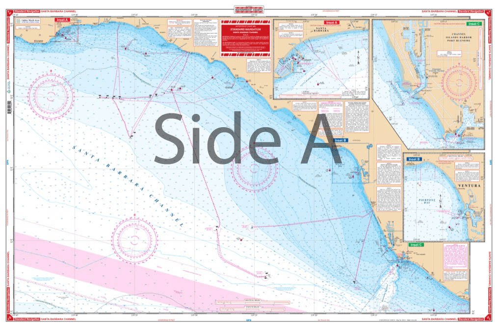
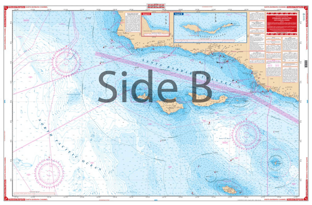


Covers the offshore area from Purisima Point southeast along the coast to Pt. Dume, south offshore to San Nicolas Island, and west to 121 degrees, 40 minutes west longitude. The reverse side details the coastal area from Santa Barbara Point to Port Hueneme. Detailed harbor blow-ups are included for Channel Islands Harbor, Ventura, Santa Barbara, Anacapa Island and Prisoners Harbor. Fueling facilities indicated. Navigate your vessel through the Santa Barbara Channel with ease using this navigation map. It covers the offshore area from Purisima Point southeast along the coast to Pt Dume, south offshore to San Nicolas Island, and west to 121 degrees, 40 minutes west longitude. The reverse side details the coastal area from Santa Barbara Point to Port Hueneme. Detailed harbor blow-ups are included for Channel Islands Harbor, Ventura, Santa Barbara, Anacapa Island and Prisoners Harbor. Fueling facilities are conveniently indicated to ensure you always have a full tank. The vibrant colors of this marine map make it excellent for framing for your home or giving as a gift. Information from 3 NOAA charts: #18720, #18729, and #18725. Nautical Chart is 25″ X 38″. WGS84 – World Mercator Datum.


I bought this book as a gift for someone who for years had had his own sailboat. He wrote to thank me for it, saying that the photos were fantastic and that he loved the book. The Black and White photography makes the photos stand out and the photos are understated and unique. Truly a wonderful book.
American National Services offered the best price on Murphy’s study guide books. They arrived quickly and in perfect condition. Can definitely recommend going through ANS. It’s worth it for your maritime career!
The chart was unusable due to too much data being printed which cluttered up the view and obscured contours. Also, no compass rose was included.
(Model Course 3.11) Safety Investigation into Marine Casualties and Incidents, 2014 Edition