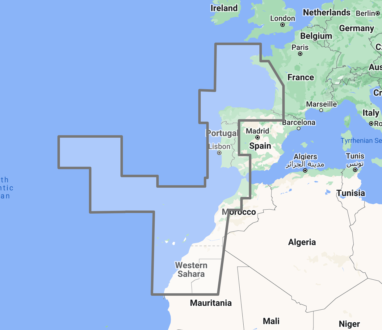
Timezero TZ Map: Gulf of Viscaya, Portugal, Açores, Madeira, Canaries
Precio
$300
No reviews
The TimeZero TZ Map: Gulf of Biscay, Portugal, Azores, Madeira, Canaries delivers comprehensive navigational coverage for the eastern Atlantic corridor connecting Northern Europe to the tropics, a passage route used by thousands of cruising yachts annually, and one of the most important commercial shipping lanes in the world. Built on the advanced TZ Maps platform developed by TimeZero, this chart pack integrates multiple chart types, official hydrographic raster charts, detailed vector data, high-resolution bathymetric data, and satellite imagery into a single navigational package supporting safe passage through waters that range from the notoriously challenging Bay of Biscay to the volcanic island harbors of the mid-Atlantic.
Coverage spans the northern Spanish Atlantic coast from the French border through Galicia, the entire Portuguese coastline from the Minho River to Cape St. Vincent and the Algarve, the Gulf of Biscay open-water crossing zone, and three Atlantic island archipelagos: the Azores (nine islands centered approximately 1,500 kilometers west of Lisbon), Madeira and Porto Santo, and the Canary Islands off the northwest African coast. This coverage area serves as the critical link for vessels transiting between the English Channel and the Mediterranean via the Atlantic route, yachts staging in the Canaries for Atlantic crossings to the Caribbean, and commercial traffic operating between Northern European ports and West Africa or South America.
Raster data within the TZ Map is georeferenced, featuring digital images of official hydrographic office charts from the Spanish Instituto Hidrografico de la Marina, the Portuguese Instituto Hidrografico, and SHOM (Service Hydrographique et Oceanographique de la Marine) for the French Biscay coast. These national services maintain distinct charting programs covering some of the most actively surveyed commercial coastlines in the Atlantic, alongside the remote volcanic island waters where survey coverage is concentrated around harbor approaches and established anchorages. Vector data complements raster imagery with a layered database recording every nautical feature, delivering queryable depth information and navigational object data across the full coverage area, including the open-ocean passages between mainland and island groups where traditional chart detail is naturally sparse.
The BathyVision feature provides dynamic 3D bottom data display essential for navigating the steep volcanic island approaches, narrow harbor entrances carved into basalt coastlines, and the shallow bar crossings that guard several major Portuguese river ports. The continental shelf edge running along the Portuguese coast creates dramatic depth transitions within a few miles of shore, and the volcanic island groups rise steeply from the Atlantic abyssal plain with minimal shallow-water buffer zones around their coastlines. High-definition satellite imagery options are available for selected port areas and popular anchorages.
Compatible with TimeZero Navigator v5 and TimeZero Professional v5 software (sold separately).
Overview
Feature Highlights Strip
Navigate with integrated raster and vector chart data sourced from official hydrographic offices and enriched with detailed nautical features.
Visualize the bottom structure with high-resolution bathymetry and BathyVision 3D contour mapping for ocean approach and island harbor navigation.
Overlay satellite photography with chart data for realistic visual identification of ports, anchorages, and coastal landmarks.
View realistic shoreline altimetry and perspective horizons to identify port entries and island approaches from offshore.
Customize chart display by toggling between raster imagery, vector layers, bathymetric overlays, and satellite views within TimeZero software.
Compatible with TimeZero Navigator v5 and TimeZero Professional v5, purpose-built for recreational and professional navigation applications.
High-Resolution Bathymetry
Navigate Volcanic Approaches and River Bar Crossings with Confidence
High-resolution bathymetric data transforms chart contour lines into intuitive 3D bottom representations, providing essential depth awareness when navigating into Atlantic island harbors, Iberian coastal ports, and the river bar entrances that guard access to major Portuguese ports. The graphic interpretation of contour data creates detailed bottom profiles invaluable for approach planning in waters where the seabed terrain is shaped by volcanic geology and Atlantic swell dynamics.
The BathyVision feature displays bottom topography in color and contour line overlays, allowing mariners to dynamically adjust the visualization to suit their navigation needs. This capability is particularly critical across this coverage area, where the Azores, Madeira, and Canary Islands rise from ocean depths exceeding 3,000 meters to above sea level within a few nautical miles, creating approach profiles where deep water transitions to harbor depth with almost no warning shelf, Portuguese river ports including Lisbon (Tagus), Porto (Douro), and Faro present bar crossings where depth, swell conditions, and tidal state must align for safe entry, and the continental shelf edge along the western Iberian coast generates steep depth gradients that affect wave behavior, current patterns, and vessel routing decisions within sight of shore.
Mariners approaching Horta in the Azores, entering Funchal harbor in Madeira, crossing the Lisbon bar into the Tagus estuary, or navigating the volcanic harbor approaches of Lanzarote and Tenerife benefit from bottom structure visualization that flat chart views cannot replicate. In open-ocean island approaches where the first indication of shallow water may be breaking swell on an unmarked reef, 3D depth awareness provides a margin of safety that traditional chart interpretation alone cannot match.
Raster and Vector Chart Fusion
Official Charts Enhanced with Intelligent Data Layers
TZ Maps combines two complementary chart formats to deliver maximum navigational confidence. Georeferenced raster data presents true-color digital copies of official hydrographic office paper charts from Spanish, Portuguese, and French national services, the same familiar chart views that mariners navigating Iberian and Atlantic island waters have relied on for decades. These images provide a reliable visual reference that experienced navigators can interpret immediately.
Vector data operates alongside raster imagery using a database-driven approach that stores information in discrete layers and records every nautical feature independently. This format enables interactive chart queries, object-based search, and depth value interrogation that static raster imagery cannot provide. Across the open-ocean passages between mainland Iberia and the Atlantic island groups, where chart detail is naturally concentrated around departure and arrival points, vector data layers provide supplementary navigational information for the transit waters between charted coastal zones.
The tri-national coverage area means mariners transit between French, Spanish, and Portuguese chart jurisdictions during passages along the Biscay and Iberian coasts, then shift to island-specific chart coverage when approaching the Azores, Madeira, or Canaries. TZ Maps integrates these multiple national datasets seamlessly, eliminating the folio management complexity of maintaining separate chart sets for each jurisdiction across a passage route that may span four countries and three island archipelagos.
Satellite Photo Overlay
See the Real Landscape Behind the Chart
TZ Maps fuses satellite photography with raster and vector chart data, presenting only the visual information essential for safe navigation. Standard-resolution satellite images are included in every TZ Maps data pack, with high-definition options available for selected areas.
This overlay capability proves especially valuable across the Atlantic islands and Iberian coast, where visual identification of harbor breakwaters, marina entrances, and anchorage positions against volcanic island terrain aids safe approach navigation. Mariners arriving at Azores harbors after multi-day ocean passages, identifying the correct approach to Canary Island marinas set into basalt cliffs, or distinguishing the entrance to Portuguese river ports from adjacent coastline, can correlate chart data with actual terrain appearance before committing to the final approach. After days of open-ocean passage, the ability to visually preview a landfall harbor before arrival restores situational awareness that extended offshore sailing naturally erodes.
Realistic Shoreline Views
Identify Port Entries and Coastal Features from the Horizon
TZ Maps employs altimetry to render shorelines with realistic elevation perspective, creating 3D views that simulate the visual horizon as seen from the bridge. This perspective rendering aids instant identification of port entrances, channel openings, and specific shoreline landmarks during approach.
The coverage area presents two contrasting coastal profiles that the altimetric rendering addresses equally well. The volcanic Atlantic islands rise dramatically from the ocean, presenting bold high-relief profiles visible from considerable distance but with multiple bays, headlands, and cliff faces that can appear similar from offshore until close approach reveals the actual harbor entrance. The southern Portuguese and Algarve coast is comparatively low-lying, where port approaches present minimal profile from seaward and must be identified by lighthouse positions, breakwater heads, and adjacent terrain features rather than dramatic coastal relief. Altimetric rendering provides visual previews calibrated to actual terrain elevation for both profiles, helping mariners confirm their approach point, whether making landfall against a 2,000-meter volcanic peak or searching for a marina entrance along a flat sandy coast.
Detailed Land Information
Understand the Coastline and Nearby Infrastructure
Beyond waterway navigation data, TZ Maps integrates detailed land information that enhances understanding of coastlines and nearby infrastructure. Road networks, settlement locations, and coastal facility positions are rendered alongside maritime chart data.
This integrated land detail is particularly valuable across the Atlantic island groups, where facility availability varies dramatically between main island commercial ports and secondary island harbors. Understanding which Azores islands offer full yacht service facilities, which Canary Island marinas provide customs clearance for transatlantic departures, and where fuel and provisioning are available along the Portuguese coast supports informed passage planning across a coverage area where the distance between full-service ports can span hundreds of nautical miles of open ocean.
Software Compatibility
Purpose-Built for TimeZero Navigation Software
The TZ Map: Gulf of Biscay, Portugal, Azores, Madeira, Canaries is designed for use with TimeZero navigation software platforms. Compatible applications include:
TimeZero Navigator v5: Full-featured navigation software for recreational and professional mariners
TimeZero Professional v5: Advanced navigation platform with commercial vessel capabilities
TZ Maps are delivered as data packs that load directly into compatible TimeZero software installations. This chart pack is not compatible with standalone chartplotters from other manufacturers. Mariners using Garmin, Raymarine, Simrad, or other hardware-based chartplotters should consult the ANS digital charts catalog for compatible chart products.
Need assistance determining the right chart format for your bridge electronics? Contact the ANS navigation team for personalized guidance on matching chart products to your vessel equipment.
Combine with TZ Map: British Islands, Ireland, English Channel for northbound passages to UK waters. Add TZ Map: Western Mediterranean for vessels transiting from the Atlantic through the Strait of Gibraltar into the Med. For yachts staging transatlantic crossings from the Canaries, TZ Map: Bahamas or TZ Map: North America provides arrival coverage on the western side. Multiple TZ Map packs load seamlessly within the same TimeZero software installation.
Atlantic Cruising Guides
Supplement digital chart data with detailed anchorage descriptions, approach instructions, passage timing advice, and local facility information from dedicated Azores, Canary Islands, and Atlantic crossing cruising guides available through ANS.
ADMIRALTY Paper Charts: Atlantic Coverage
Commercial vessels subject to SOLAS chart carriage requirements should maintain official paper chart backup for primary navigation areas. ADMIRALTY charts covering the Bay of Biscay, Iberian coast, and Atlantic island groups are available through the ANS Chart Selector.
Need Help Choosing the Right Charting Solution?
The ANS navigation team provides personalized guidance on chart selection, software compatibility, and compliance requirements for vessels of all types. Whether outfitting a yacht for an Atlantic circuit or equipping a commercial vessel for Iberian and West African trading routes, ANS specialists match chart products to your vessel, cruising plans, and bridge electronics.
Phone: +1 (954) 522-3321
WhatsApp: +1 (954) 292-4212
Email: sales@amnautical.com
Hours: Mon-Fri 8 am-5 pm | Sat 9 am-5 pm EST
FAQs
Q1. What areas does the TZ Map: Gulf of Biscay, Portugal, Azores, Madeira, Canaries cover?
This chart pack provides navigational coverage for the northern Spanish Atlantic coast, the full Portuguese coastline, including the Algarve, the Gulf of Biscay open-water crossing zone, and three Atlantic island archipelagos: the Azores (nine islands), Madeira and Porto Santo, and the Canary Islands.
Q2. What software is required to use TZ Maps?
TZ Maps require TimeZero Navigator v5 or TimeZero Professional v5 software installed on a compatible computer system. TZ Maps do not operate on standalone chartplotters from other manufacturers.
Q3. Can TZ Maps be used for SOLAS chart carriage compliance?
TZ Maps are designed for navigation planning and situational awareness. Vessels subject to SOLAS Chapter V carriage requirements should verify that their chart products and navigation equipment meet applicable flag state standards. Contact ANS for guidance on SOLAS-compliant chart solutions.
Q4. What chart data types are included in the TZ Map pack?
Each TZ Map pack integrates georeferenced raster charts (official hydrographic office imagery from Spanish, Portuguese, and French national services), vector chart data, high-resolution bathymetry with BathyVision 3D display, satellite photography overlay, and detailed land information, including coastline features and infrastructure.
Q5. Can multiple TZ Map regions be used simultaneously?
Multiple TZ Map data packs can be installed within the same TimeZero software environment, providing seamless coverage transitions when navigating between regions. Combining this pack with TZ Map: British Islands provides complete English Channel-to-Canaries coverage. Adding TZ Map: Bahamas or TZ Map: North America extends the chart library for transatlantic crossings staged from the Canary Islands.
Order placement and pickup was efficient and easy! I made an order mistake and they fixed it quickly for me. Hal was such a pleasure to talk to as well. Product is as described. Thanks!
My wife and I are still a few years away from casting off the dock lines on this journey, but Skipper Bob's insights have really framed my thinking about the Big Picture. I burned through the book in just a few days and have already changed some of our early planning based on the information I gleaned.
Thanks to all of you for keeping this valuable resource readily available!