CFR Title 46: Parts 140-155 – Shipping (Code of Federal Regulations), Revised as of October 1, 2025
Mancomm 29 CFR Part 1926 OSHA Construction Standards & Regulations, January 2026
Normalmente está listo en 24 horas
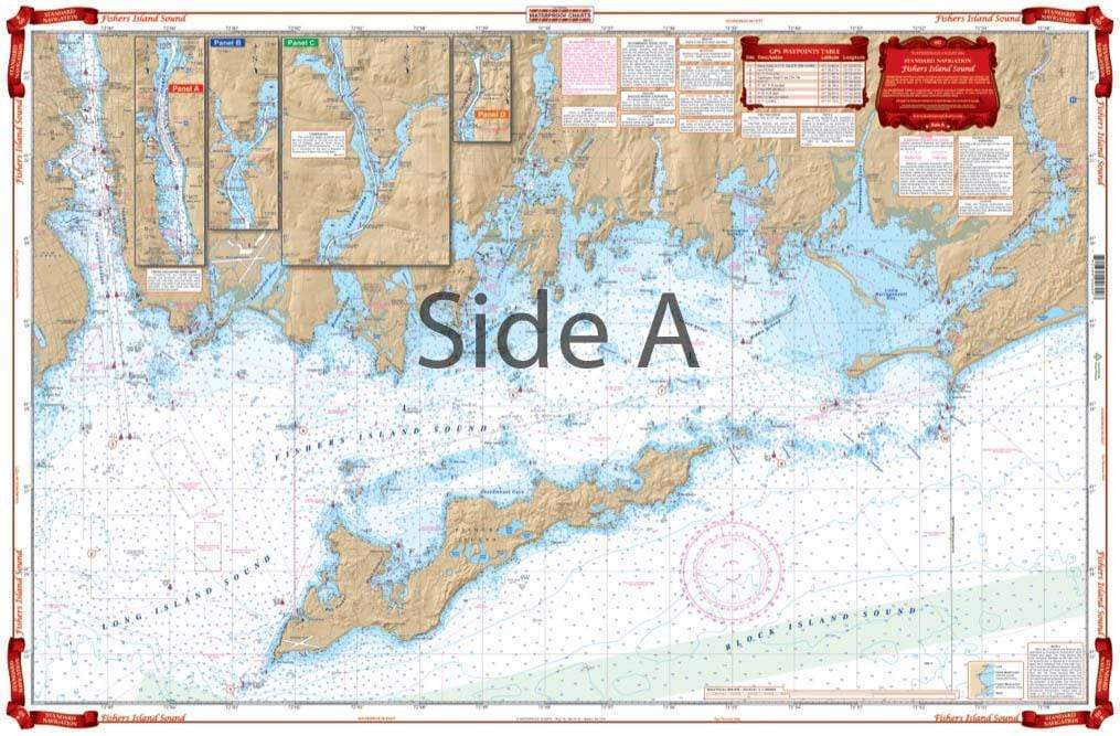
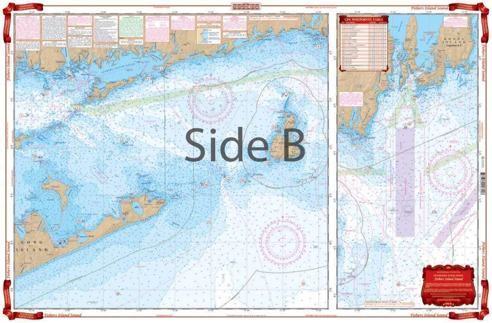
A great combination of 5 government charts. This chart provides good detail from Watch Hill west through Fishers Island Sound to the Thames River and upriver to north of Bartlett Point. The chart includes the Pawcatuck River, Stonington, Mystic Harbor, Noank and New London Harbor, and all of Fishers Island. The reverse side covers the Block Island Sound area including Plum Island and Gardiners Island, and Block Island west to Niantic and east to Newport, Rhode Island. Includes information from NOAA Charts: #13218, #13205, #13214, #13212, and #13372. This nautical map is comprised of 5 NOAA charts. You won’t find more detail than this in any other navigation chart. This navigation map provides pristine detail from Watch Hill RI west through Fishers Island Sound to the Thames River and upriver to north of Bartlett Point. The chart includes the Pawcatuck River, Stonington, Mystic Harbor, Noank and New London Harbor, and all of Fishers Island. The reverse side covers the Block Island Sound area including Plum Island and Gardiners Island, and Block Island west to Niantic and east to Newport, Rhode Island. This is an excellent chart for plotting a nautical journey, giving as a gift, or framing and displaying in your home or office. Includes information from NOAA Charts: #13218, #13205, #13214, #13212, and #13372. Nautical Chart is 25″ X 38″. WGS84 – World Mercator Datum.
Phone: +1 954-522-3321
Whatsapp: +1 954-292-4212
E-mail: sales@amnautical.com
Review us on Google!
American Nautical Services, Inc.
3311 S Andrews Ave, Suite 11
Fort Lauderdale, FL 33316
United States of America
Mon-Fri 8am-5pm - Sat. 9am-5pm
Great service!
CFR Title 46: Parts 140-155 – Shipping (Code of Federal Regulations), Revised as of October 1, 2025
Mancomm 29 CFR Part 1926 OSHA Construction Standards & Regulations, January 2026