Double click image to zoom in

Usually ready in 24 hours
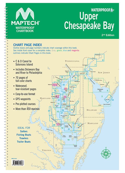
Covers C&D Canal to Solomons Island and includes Delaware Bay and River to Philadelphia. Offers full-color charts on waterproof, tear-resistant pages. Easy-to-use format includes GPS waypoints, pre-plotted courses and more than 450 marinas. 70 chart pages. 12 X 17". WATERPROOF!

+1 954-522-3321
sales@amnautical.com
American Nautical Services, Inc.
3311 S Andrews Ave, Suite 11
Fort Lauderdale, FL 33316
United States of America
Notify me when available
We will send you a notification as soon as this product is available again.
We don't share your email with anybody


