Double click image to zoom in
Usually ready in 24 hours
Looking to go digital with your Passage Planning? Check out our Simple E-Navigation Software, SPICA!
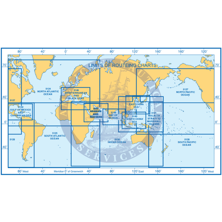
Essential for use in passage planning for ocean voyages, Routeing Charts include routes and distances between major ports, ocean currents, ice limits, load lines and wind roses. They also contain expected meteorological and oceanographic conditions for each month of the year.
Admiralty Routing Paper Charts (United Kingdom Hydrographic Office – UKHO)
Great price and quick delivery!!
Great price and quick delivery!!

+1 954-522-3321
sales@amnautical.com
American Nautical Services, Inc.
3311 S Andrews Ave, Suite 11
Fort Lauderdale, FL 33316
United States of America
Notify me when available
We will send you a notification as soon as this product is available again.
We don't share your email with anybody


