Collection: NOAA Paper Charts - Great Lakes
Discover the beauty and majesty of the Great Lakes with our collection of NOAA Nautical Paper Charts. Fully up to date with the latest corrections and notices to mariners, these charts provide essential information for safe navigation. From Lake Champlain to Lake of the Woods, explore the intricate waterways of the Great Lakes region with confidence. Whether you're a seasoned sailor or a novice explorer, these charts offer detailed coverage of key areas, ensuring you have the information you need for a successful voyage. Dive into our collection today and embark on your next maritime adventure with the assurance of accurate and reliable navigation aids.
- NOAA Nautical Chart 14863: Saginaw Bay; Port Austin Harbor; Caseville Harbor; Entrance to Au Sable River; Sebewaing Harbor; Tawas Harbor

- Regular price
- $29.95
- Sale price
- $24.95
- NOAA Nautical Chart 14864: Harrisville to Forty Mile Point; Harrisville Harbor; Alpena; Rogers City and Calcite

- Regular price
- $29.95
- Sale price
- $24.95
-
-
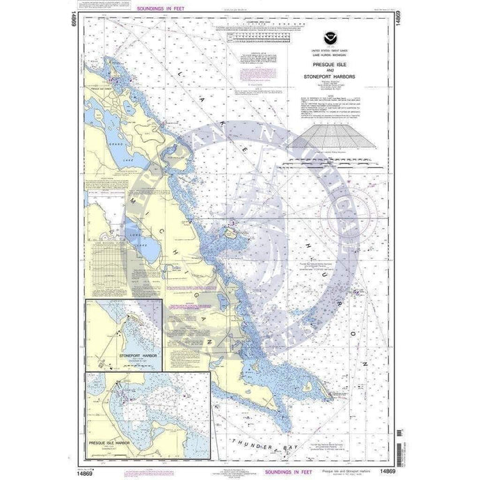
- NOAA Nautical Chart 14869: Thunder Bay Island to Presque Isle;Stoneport Harbor;Resque Isle Harbor
- Regular price
- $27.00
- Sale price
- $24.95
-


- Previous page
- Page 10 of 12
- Next page