Collection: National Oceanic and Atmospheric Administration
Explore the vast expanse of maritime knowledge with our National Oceanic and Atmospheric Administration collection. From detailed U.S. Coast Pilots to essential Hurricane Tracking Charts, this collection provides a comprehensive array of nautical resources for sailors, navigators, and marine enthusiasts. Discover NOAA's extensive catalog of charts covering the Atlantic, Pacific, Gulf Coast, Great Lakes, and Alaska regions. Stay informed and prepared with the latest editions and updates to ensure safe and successful voyages. Invest in the best tools for maritime navigation and exploration with NOAA's trusted and reliable products. Dive into the world of marine navigation today!
- NOAA Nautical Chart 18704: San Luis Obispo Bay, Port San Luis

- Regular price
- $32.95
- Sale price
- $27.95
-
-
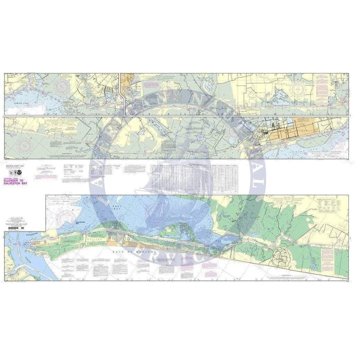
- NOAA Nautical Chart 11331: Intracoastal Waterway Ellender to Galveston Bay
- Regular price
- $32.95
- Sale price
- $27.95
- NOAA Nautical Chart 12263: Chesapeake Bay Cove Point to Sandy Point

- Regular price
- $32.95
- Sale price
- $27.95
-


- Previous page
- Page 171 of 173
- Next page